

kings highway and canal clayton rishton and back home
A cycling route starting in Accrington, England, United Kingdom.
Overview
About this route
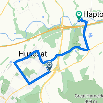
Sett off heading towards accy centre,head to old railway track , come off at hollands pies .Sraight up to kings highway .Turn left then left again down rabbit run,on to the canal via clayton,rishton ,back through tokky back on canal cut across field missing out ossy.Come off canal at clayton up whalley rd back home.
(cloned from route 2240225)
- -:--
- Duration
- 32 km
- Distance
- 266 m
- Ascent
- 267 m
- Descent
- ---
- Avg. speed
- ---
- Max. altitude
Continue with Bikemap
Use, edit, or download this cycling route
You would like to ride kings highway and canal clayton rishton and back home or customize it for your own trip? Here is what you can do with this Bikemap route:
Free features
- Save this route as favorite or in collections
- Copy & plan your own version of this route
- Sync your route with Garmin or Wahoo
Premium features
Free trial for 3 days, or one-time payment. More about Bikemap Premium.
- Navigate this route on iOS & Android
- Export a GPX / KML file of this route
- Create your custom printout (try it for free)
- Download this route for offline navigation
Discover more Premium features.
Get Bikemap PremiumFrom our community
Other popular routes starting in Accrington
 4 Rose Place, Accrington to 11 Worston Close, Accrington
- Distance
- 17.7 km
- Ascent
- 324 m
- Descent
- 351 m
- Location
- Accrington, England, United Kingdom
 344 Burnley Road, Accrington to 1–73 Parker St, Huncoat, Accrington
- Distance
- 24.4 km
- Ascent
- 230 m
- Descent
- 231 m
- Location
- Accrington, England, United Kingdom
 Burnley Road 562, Huncoat to Simpson Street 67, Hapton
- Distance
- 6.2 km
- Ascent
- 96 m
- Descent
- 204 m
- Location
- Accrington, England, United Kingdom
 accy enduro
- Distance
- 15.9 km
- Ascent
- 466 m
- Descent
- 466 m
- Location
- Accrington, England, United Kingdom
 Montgomery Close 26 to Montgomery Close 26
- Distance
- 16.3 km
- Ascent
- 126 m
- Descent
- 137 m
- Location
- Accrington, England, United Kingdom
 Moderate route in
- Distance
- 31.1 km
- Ascent
- 101 m
- Descent
- 213 m
- Location
- Accrington, England, United Kingdom
 Montgomery Close 26 to Montgomery Close 28
- Distance
- 32.6 km
- Ascent
- 340 m
- Descent
- 346 m
- Location
- Accrington, England, United Kingdom
 Cannon Street 21 to Burnley Road 5, Padiham
- Distance
- 8.8 km
- Ascent
- 69 m
- Descent
- 132 m
- Location
- Accrington, England, United Kingdom
Open it in the app