

St Leonhard im Passeiertal- Timmelsjoch
A cycling route starting in St. Leonhard in Passeier, Trentino-Alto Adige, Italy.
Overview
About this route
23-7-2013
- -:--
- Duration
- 58 km
- Distance
- 2,064 m
- Ascent
- 2,064 m
- Descent
- ---
- Avg. speed
- ---
- Max. altitude

Route quality
Waytypes & surfaces along the route
Surfaces
Paved
58 km
(100 %)
Asphalt
58 km
(100 %)
Continue with Bikemap
Use, edit, or download this cycling route
You would like to ride St Leonhard im Passeiertal- Timmelsjoch or customize it for your own trip? Here is what you can do with this Bikemap route:
Free features
- Save this route as favorite or in collections
- Copy & plan your own version of this route
- Sync your route with Garmin or Wahoo
Premium features
Free trial for 3 days, or one-time payment. More about Bikemap Premium.
- Navigate this route on iOS & Android
- Export a GPX / KML file of this route
- Create your custom printout (try it for free)
- Download this route for offline navigation
Discover more Premium features.
Get Bikemap PremiumFrom our community
Other popular routes starting in St. Leonhard in Passeier
 Percorso GPX - Percorso selezionato
- Distance
- 24.2 km
- Ascent
- 161 m
- Descent
- 544 m
- Location
- St. Leonhard in Passeier, Trentino-Alto Adige, Italy
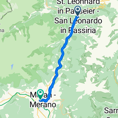
 Strada Principale 25A, San Leonardo in Passiria to Via delle Piante 36, Merano
- Distance
- 33.5 km
- Ascent
- 767 m
- Descent
- 1,152 m
- Location
- St. Leonhard in Passeier, Trentino-Alto Adige, Italy
 St Leonhard im Passeiertal- Timmelsjoch
- Distance
- 58 km
- Ascent
- 2,064 m
- Descent
- 2,064 m
- Location
- St. Leonhard in Passeier, Trentino-Alto Adige, Italy
 St.Leonhard - Meran
- Distance
- 19.7 km
- Ascent
- 55 m
- Descent
- 431 m
- Location
- St. Leonhard in Passeier, Trentino-Alto Adige, Italy
 Ötz: StLeonh-Jaufenpass
- Distance
- 19.9 km
- Ascent
- 1,428 m
- Descent
- 0 m
- Location
- St. Leonhard in Passeier, Trentino-Alto Adige, Italy
 paso rombo
- Distance
- 29 km
- Ascent
- 2,153 m
- Descent
- 359 m
- Location
- St. Leonhard in Passeier, Trentino-Alto Adige, Italy
 Passaiertal - Kaltern - Auer
- Distance
- 67.2 km
- Ascent
- 403 m
- Descent
- 856 m
- Location
- St. Leonhard in Passeier, Trentino-Alto Adige, Italy
 PERCORSO OEZTALER RADMARATHON
- Distance
- 226.1 km
- Ascent
- 4,832 m
- Descent
- 4,832 m
- Location
- St. Leonhard in Passeier, Trentino-Alto Adige, Italy
Open it in the app