

Andalgala - Santa Maria por Minas Capillitas
A cycling route starting in Andalgalá, Catamarca Province, Argentina.
Overview
About this route
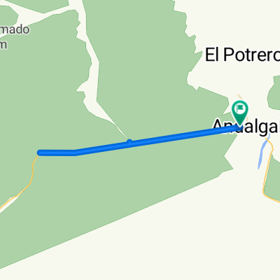
Climbing the Cuesta de Minas Capillitas and then crossing the desert to Punta Balasto.
- -:--
- Duration
- 143.1 km
- Distance
- 2,345 m
- Ascent
- 1,538 m
- Descent
- ---
- Avg. speed
- ---
- Max. altitude

Continue with Bikemap
Use, edit, or download this cycling route
You would like to ride Andalgala - Santa Maria por Minas Capillitas or customize it for your own trip? Here is what you can do with this Bikemap route:
Free features
- Save this route as favorite or in collections
- Copy & plan your own version of this route
- Split it into stages to create a multi-day tour
- Sync your route with Garmin or Wahoo
Premium features
Free trial for 3 days, or one-time payment. More about Bikemap Premium.
- Navigate this route on iOS & Android
- Export a GPX / KML file of this route
- Create your custom printout (try it for free)
- Download this route for offline navigation
Discover more Premium features.
Get Bikemap PremiumFrom our community
Other popular routes starting in Andalgalá
 aguada
- Distance
- 9.3 km
- Ascent
- 194 m
- Descent
- 218 m
- Location
- Andalgalá, Catamarca Province, Argentina
 D3 - Vuelta x Aconquija/Andalgala
- Distance
- 58.8 km
- Ascent
- 1,103 m
- Descent
- 616 m
- Location
- Andalgalá, Catamarca Province, Argentina
 Ascensos en Catamarca
- Distance
- 971.2 km
- Ascent
- 7,696 m
- Descent
- 7,939 m
- Location
- Andalgalá, Catamarca Province, Argentina
 Andalgala - Santa Maria por Minas Capillitas
- Distance
- 143.1 km
- Ascent
- 2,345 m
- Descent
- 1,538 m
- Location
- Andalgalá, Catamarca Province, Argentina
 VUELTA ANDALGALA
- Distance
- 121.3 km
- Ascent
- 3,423 m
- Descent
- 3,429 m
- Location
- Andalgalá, Catamarca Province, Argentina
 Etapa 2 Buena Vista a Andalgala
- Distance
- 54 km
- Ascent
- 491 m
- Descent
- 1,047 m
- Location
- Andalgalá, Catamarca Province, Argentina
 Ruta moderata1
- Distance
- 48.6 km
- Ascent
- 198 m
- Descent
- 236 m
- Location
- Andalgalá, Catamarca Province, Argentina
 De Ruta Provincial 46, Andalgalá a Ruta Provincial 46, Andalgalá
- Distance
- 34.8 km
- Ascent
- 375 m
- Descent
- 368 m
- Location
- Andalgalá, Catamarca Province, Argentina
Open it in the app