
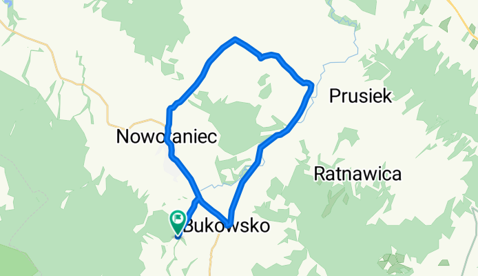
Pogórze Bukowskie
A cycling route starting in Bukowsko, Subcarpathian Voivodeship, Poland.
Overview
About this route
A trip in my free time at my brother-in-law's on vacation
- -:--
- Duration
- 22.2 km
- Distance
- 183 m
- Ascent
- 182 m
- Descent
- ---
- Avg. speed
- ---
- Max. altitude

Route quality
Waytypes & surfaces along the route
Waytypes
Road
10.7 km
(48 %)
Quiet road
6.9 km
(31 %)
Undefined
4.7 km
(21 %)
Surfaces
Paved
18.9 km
(85 %)
Asphalt
18.9 km
(85 %)
Undefined
3.3 km
(15 %)
Route highlights
Points of interest along the route

Point of interest after 2 km

Point of interest after 12.5 km

Point of interest after 17.7 km

Point of interest after 19.9 km
Continue with Bikemap
Use, edit, or download this cycling route
You would like to ride Pogórze Bukowskie or customize it for your own trip? Here is what you can do with this Bikemap route:
Free features
- Save this route as favorite or in collections
- Copy & plan your own version of this route
- Sync your route with Garmin or Wahoo
Premium features
Free trial for 3 days, or one-time payment. More about Bikemap Premium.
- Navigate this route on iOS & Android
- Export a GPX / KML file of this route
- Create your custom printout (try it for free)
- Download this route for offline navigation
Discover more Premium features.
Get Bikemap PremiumFrom our community
Other popular routes starting in Bukowsko
 Bukowsko Half
- Distance
- 48.1 km
- Ascent
- 1,418 m
- Descent
- 1,416 m
- Location
- Bukowsko, Subcarpathian Voivodeship, Poland
 Pogórze Bukowskie
- Distance
- 22.2 km
- Ascent
- 183 m
- Descent
- 182 m
- Location
- Bukowsko, Subcarpathian Voivodeship, Poland
 2018.09.21 Beskid Niski 3/3 Bukowsko- Rzeszów
- Distance
- 107.6 km
- Ascent
- 259 m
- Descent
- 575 m
- Location
- Bukowsko, Subcarpathian Voivodeship, Poland
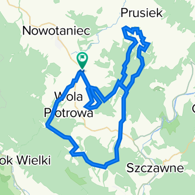
 Do galerii w Woli Piotrowej :)
- Distance
- 8.7 km
- Ascent
- 137 m
- Descent
- 77 m
- Location
- Bukowsko, Subcarpathian Voivodeship, Poland
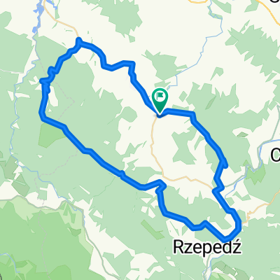
 Tokarnia - TOKARNIA (778) - Tokarnia
- Distance
- 12.9 km
- Ascent
- 386 m
- Descent
- 386 m
- Location
- Bukowsko, Subcarpathian Voivodeship, Poland
 Bukowsko - Tokarnia - Jasiel
- Distance
- 78.7 km
- Ascent
- 833 m
- Descent
- 836 m
- Location
- Bukowsko, Subcarpathian Voivodeship, Poland
 2011-04-16 Bieszczady: Chryszczata (998m), Przełęcz Żebrak (816m), Przęłęcz Przysłup (749m), Przełęcz nad Roztokami (801m), Okrąglik (1101), Jasło (1153)
- Distance
- 87.2 km
- Ascent
- 1,432 m
- Descent
- 1,386 m
- Location
- Bukowsko, Subcarpathian Voivodeship, Poland
 Bukowica, Tokarnia, Rzepedka, Jworzynka
- Distance
- 57.2 km
- Ascent
- 1,085 m
- Descent
- 1,088 m
- Location
- Bukowsko, Subcarpathian Voivodeship, Poland
Open it in the app