
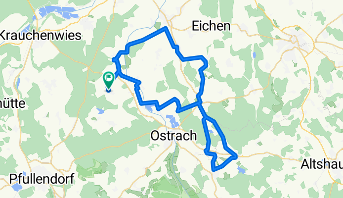
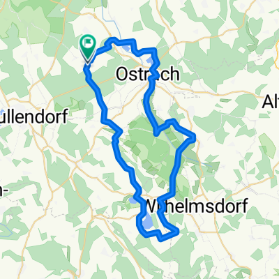
Radfahrverein Rosna Wanderradfahren am 21.07.2013
A cycling route starting in Ostrach, Baden-Württemberg, Germany.
Overview
About this route
Radroute Wanderradfahren Rosna am 21.07.2013
- -:--
- Duration
- 43.2 km
- Distance
- 253 m
- Ascent
- 253 m
- Descent
- ---
- Avg. speed
- ---
- Max. altitude
Route quality
Waytypes & surfaces along the route
Waytypes
Quiet road
24.5 km
(57 %)
Road
10.8 km
(25 %)
Surfaces
Paved
14.3 km
(33 %)
Unpaved
2.3 km
(5 %)
Asphalt
13 km
(30 %)
Gravel
1.6 km
(4 %)
Continue with Bikemap
Use, edit, or download this cycling route
You would like to ride Radfahrverein Rosna Wanderradfahren am 21.07.2013 or customize it for your own trip? Here is what you can do with this Bikemap route:
Free features
- Save this route as favorite or in collections
- Copy & plan your own version of this route
- Sync your route with Garmin or Wahoo
Premium features
Free trial for 3 days, or one-time payment. More about Bikemap Premium.
- Navigate this route on iOS & Android
- Export a GPX / KML file of this route
- Create your custom printout (try it for free)
- Download this route for offline navigation
Discover more Premium features.
Get Bikemap PremiumFrom our community
Other popular routes starting in Ostrach
 Ostrach-Donautal-Ablachtal-Ostrach
- Distance
- 70 km
- Ascent
- 798 m
- Descent
- 787 m
- Location
- Ostrach, Baden-Württemberg, Germany
 Radfahrverein Rosna Wanderradfahren am 21.07.2013
- Distance
- 43.2 km
- Ascent
- 253 m
- Descent
- 253 m
- Location
- Ostrach, Baden-Württemberg, Germany
 Ostrach - Geltendorf
- Distance
- 150.4 km
- Ascent
- 529 m
- Descent
- 580 m
- Location
- Ostrach, Baden-Württemberg, Germany
 Pfrungener Ried
- Distance
- 28.3 km
- Ascent
- 156 m
- Descent
- 162 m
- Location
- Ostrach, Baden-Württemberg, Germany
 Über den Höchsten und den Judentenberg
- Distance
- 56.5 km
- Ascent
- 607 m
- Descent
- 610 m
- Location
- Ostrach, Baden-Württemberg, Germany
 Ostrach-Sigmaringen-Alb-Bärenhöhle-Laucherttal-Ostrach
- Distance
- 131 km
- Ascent
- 811 m
- Descent
- 811 m
- Location
- Ostrach, Baden-Württemberg, Germany
 Ostrach-auf d´Alb-´s Lauchertal na-Ostrach
- Distance
- 133.2 km
- Ascent
- 815 m
- Descent
- 815 m
- Location
- Ostrach, Baden-Württemberg, Germany
 Illmensee
- Distance
- 46.5 km
- Ascent
- 563 m
- Descent
- 564 m
- Location
- Ostrach, Baden-Württemberg, Germany
Open it in the app