

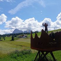
Kastelruth-Panorama
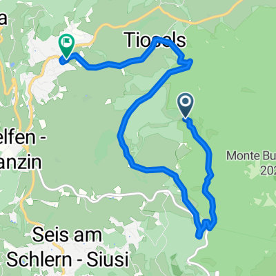
A cycling route starting in Kastelruth, Trentino-Alto Adige, Italy.
Overview
About this route
The access route, beginning and ending on asphalt, in the middle there are many beautiful views.
- -:--
- Duration
- 40.5 km
- Distance
- 1,233 m
- Ascent
- 1,233 m
- Descent
- ---
- Avg. speed
- ---
- Max. altitude
Continue with Bikemap
Use, edit, or download this cycling route
You would like to ride Kastelruth-Panorama or customize it for your own trip? Here is what you can do with this Bikemap route:
Free features
- Save this route as favorite or in collections
- Copy & plan your own version of this route
- Sync your route with Garmin or Wahoo
Premium features
Free trial for 3 days, or one-time payment. More about Bikemap Premium.
- Navigate this route on iOS & Android
- Export a GPX / KML file of this route
- Create your custom printout (try it for free)
- Download this route for offline navigation
Discover more Premium features.
Get Bikemap PremiumFrom our community
Other popular routes starting in Kastelruth
 11.7. - Kastelruth - Weisslahnbad
- Distance
- 51.1 km
- Ascent
- 1,088 m
- Descent
- 1,089 m
- Location
- Kastelruth, Trentino-Alto Adige, Italy
 ALPE DI SUISI (por Castellrotto)
- Distance
- 11.5 km
- Ascent
- 924 m
- Descent
- 154 m
- Location
- Kastelruth, Trentino-Alto Adige, Italy
 Giro2015 15.etape
- Distance
- 26.1 km
- Ascent
- 894 m
- Descent
- 895 m
- Location
- Kastelruth, Trentino-Alto Adige, Italy
 Telfen 58, Telfen-Lanzin do Telfen-Lanzin 59a, Castelrotto
- Distance
- 14 km
- Ascent
- 1 m
- Descent
- 77 m
- Location
- Kastelruth, Trentino-Alto Adige, Italy
 Moderate Route
- Distance
- 7.9 km
- Ascent
- 59 m
- Descent
- 546 m
- Location
- Kastelruth, Trentino-Alto Adige, Italy
 Castelrotto-Cortina
- Distance
- 41 km
- Ascent
- 1,801 m
- Descent
- 1,255 m
- Location
- Kastelruth, Trentino-Alto Adige, Italy
 2016 Giro D'Italia Stage 15
- Distance
- 11.1 km
- Ascent
- 819 m
- Descent
- 29 m
- Location
- Kastelruth, Trentino-Alto Adige, Italy
 Telfen.. St. Konstantin.. Vols.. Volser weiher.. Telfen
- Distance
- 24.1 km
- Ascent
- 664 m
- Descent
- 665 m
- Location
- Kastelruth, Trentino-Alto Adige, Italy
Open it in the app