

Maasholm-Geltinger Birk-Küstenweg
A cycling route starting in Høruphav, Region South Denmark, Denmark.
Overview
About this route
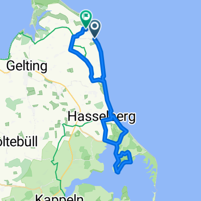
Half of the route always runs along the bay. From Wormshöft to Ohrfeldhaff, water is visible almost all the time.
- -:--
- Duration
- 53.9 km
- Distance
- 71 m
- Ascent
- 72 m
- Descent
- ---
- Avg. speed
- ---
- Max. altitude

Route quality
Waytypes & surfaces along the route
Waytypes
Track
15.1 km
(28 %)
Quiet road
14 km
(26 %)
Surfaces
Paved
29.1 km
(54 %)
Unpaved
22.6 km
(42 %)
Asphalt
29.1 km
(54 %)
Gravel
15.1 km
(28 %)
Continue with Bikemap
Use, edit, or download this cycling route
You would like to ride Maasholm-Geltinger Birk-Küstenweg or customize it for your own trip? Here is what you can do with this Bikemap route:
Free features
- Save this route as favorite or in collections
- Copy & plan your own version of this route
- Sync your route with Garmin or Wahoo
Premium features
Free trial for 3 days, or one-time payment. More about Bikemap Premium.
- Navigate this route on iOS & Android
- Export a GPX / KML file of this route
- Create your custom printout (try it for free)
- Download this route for offline navigation
Discover more Premium features.
Get Bikemap PremiumFrom our community
Other popular routes starting in Høruphav
 Route 66
- Distance
- 60.2 km
- Ascent
- 220 m
- Descent
- 216 m
- Location
- Høruphav, Region South Denmark, Denmark
 Route von Kegnæsvej, Sydals
- Distance
- 10.3 km
- Ascent
- 6 m
- Descent
- 6 m
- Location
- Høruphav, Region South Denmark, Denmark
 Bredsten 5, Sydals nach Nørre Landevej v Bredsten (Kegnæs), Sydals
- Distance
- 22.5 km
- Ascent
- 150 m
- Descent
- 149 m
- Location
- Høruphav, Region South Denmark, Denmark
 Steady ride in Nordborg
- Distance
- 26.2 km
- Ascent
- 242 m
- Descent
- 257 m
- Location
- Høruphav, Region South Denmark, Denmark
 Maasholm-Geltinger Birk-Küstenweg
- Distance
- 53.9 km
- Ascent
- 71 m
- Descent
- 72 m
- Location
- Høruphav, Region South Denmark, Denmark
 Tag 2 Als Kloster nach Fynshav
- Distance
- 19 km
- Ascent
- 77 m
- Descent
- 92 m
- Location
- Høruphav, Region South Denmark, Denmark
 Als-Tour
- Distance
- 51.3 km
- Ascent
- 170 m
- Descent
- 169 m
- Location
- Høruphav, Region South Denmark, Denmark
 Gammeldamm nach Falshöft
- Distance
- 29.3 km
- Ascent
- 38 m
- Descent
- 37 m
- Location
- Høruphav, Region South Denmark, Denmark
Open it in the app