

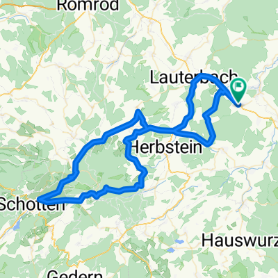
Landenhausen-Schotten-Runde
A cycling route starting in Bad Salzschlirf, Hesse, Germany.
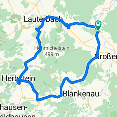
Overview
About this route
Landenhausen-Angersbach-Rudlos-Schadges-Rixfelderkreuz-Eichenrod-Eichelhain-Lanzenhain-Affroad Hoherodskopf(550m ü.NN)-Watershed Rhein/Weser-Breungeshain-Schotten-Rudigshain-Rebgeshain-Engelrod-Hopfmannsfeld-Rixfelder Kreuz-Blitzenrod(Sprint score with 'Finish photo')-Lauterbach-Angersbach-Landenhausen
- -:--
- Duration
- 80.2 km
- Distance
- 1,276 m
- Ascent
- 1,185 m
- Descent
- ---
- Avg. speed
- 763 m
- Max. altitude

Route quality
Waytypes & surfaces along the route
Waytypes
Road
12 km
(15 %)
Track
7.2 km
(9 %)
Surfaces
Paved
61.8 km
(77 %)
Unpaved
5.6 km
(7 %)
Asphalt
61 km
(76 %)
Ground
3.2 km
(4 %)
Continue with Bikemap
Use, edit, or download this cycling route
You would like to ride Landenhausen-Schotten-Runde or customize it for your own trip? Here is what you can do with this Bikemap route:
Free features
- Save this route as favorite or in collections
- Copy & plan your own version of this route
- Split it into stages to create a multi-day tour
- Sync your route with Garmin or Wahoo
Premium features
Free trial for 3 days, or one-time payment. More about Bikemap Premium.
- Navigate this route on iOS & Android
- Export a GPX / KML file of this route
- Create your custom printout (try it for free)
- Download this route for offline navigation
Discover more Premium features.
Get Bikemap PremiumFrom our community
Other popular routes starting in Bad Salzschlirf
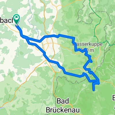 Bd Salzschlirf, Wasserkuppe, Kreuzberg
- Distance
- 135 km
- Ascent
- 1,819 m
- Descent
- 1,852 m
- Location
- Bad Salzschlirf, Hesse, Germany
 Landenhausen_Hahn
- Distance
- 144.8 km
- Ascent
- 585 m
- Descent
- 769 m
- Location
- Bad Salzschlirf, Hesse, Germany
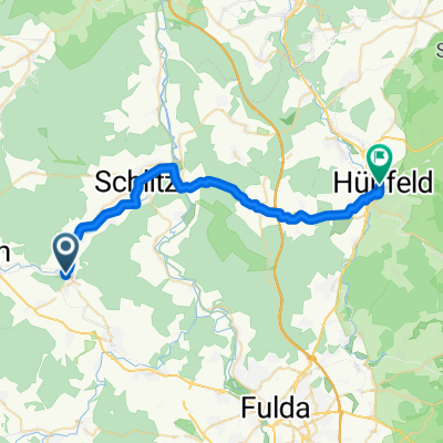 Bad Salzschlirf - Hünfeld
- Distance
- 27.4 km
- Ascent
- 199 m
- Descent
- 187 m
- Location
- Bad Salzschlirf, Hesse, Germany
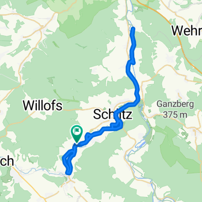 Lange Ausfahrt durch Schlitz
- Distance
- 38 km
- Ascent
- 194 m
- Descent
- 197 m
- Location
- Bad Salzschlirf, Hesse, Germany
 shuq-club-mountainbike-Runde
- Distance
- 51.4 km
- Ascent
- 796 m
- Descent
- 796 m
- Location
- Bad Salzschlirf, Hesse, Germany
 Landenhausen-Schotten-Runde CLONED FROM ROUTE 22460
- Distance
- 80.2 km
- Ascent
- 1,276 m
- Descent
- 1,185 m
- Location
- Bad Salzschlirf, Hesse, Germany
 Vogelsberg-Vulkanradweg CLONED FROM ROUTE 155085
- Distance
- 45 km
- Ascent
- 441 m
- Descent
- 415 m
- Location
- Bad Salzschlirf, Hesse, Germany
 Kindertour 4 bis Friedlos
- Distance
- 48.6 km
- Ascent
- 106 m
- Descent
- 143 m
- Location
- Bad Salzschlirf, Hesse, Germany
Open it in the app