

NJKČR - 2. etapa
A cycling route starting in Lanžhot, South Moravian, Czechia.
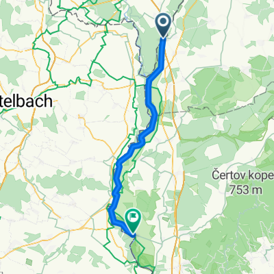
Overview
About this route
Second stage out of a total of 30. On a unicycle around the country :)
- -:--
- Duration
- 76.5 km
- Distance
- 263 m
- Ascent
- 111 m
- Descent
- ---
- Avg. speed
- ---
- Max. altitude

Route quality
Waytypes & surfaces along the route
Waytypes
Track
40.6 km
(53 %)
Access road
19.9 km
(26 %)
Surfaces
Paved
31.4 km
(41 %)
Unpaved
35.2 km
(46 %)
Asphalt
30.6 km
(40 %)
Gravel
26.8 km
(35 %)
Continue with Bikemap
Use, edit, or download this cycling route
You would like to ride NJKČR - 2. etapa or customize it for your own trip? Here is what you can do with this Bikemap route:
Free features
- Save this route as favorite or in collections
- Copy & plan your own version of this route
- Sync your route with Garmin or Wahoo
Premium features
Free trial for 3 days, or one-time payment. More about Bikemap Premium.
- Navigate this route on iOS & Android
- Export a GPX / KML file of this route
- Create your custom printout (try it for free)
- Download this route for offline navigation
Discover more Premium features.
Get Bikemap PremiumFrom our community
Other popular routes starting in Lanžhot
 Moravsko-Slovensko-Rakouská,lehká
- Distance
- 49.3 km
- Ascent
- 142 m
- Descent
- 142 m
- Location
- Lanžhot, South Moravian, Czechia
 Moravská cyklocesta - Južná časť
- Distance
- 47.9 km
- Ascent
- 13 m
- Descent
- 17 m
- Location
- Lanžhot, South Moravian, Czechia
 Day 7 Lanžhot to Stupava
- Distance
- 77.8 km
- Ascent
- 65 m
- Descent
- 56 m
- Location
- Lanžhot, South Moravian, Czechia
 2. etapa - Pohansko - Lipov
- Distance
- 73.8 km
- Ascent
- 199 m
- Descent
- 113 m
- Location
- Lanžhot, South Moravian, Czechia
 Kolem ČR 5.
- Distance
- 327.3 km
- Ascent
- 3,585 m
- Descent
- 3,162 m
- Location
- Lanžhot, South Moravian, Czechia
 Lehká ,rovinnatá trasa Lanžhot-Buková
- Distance
- 53.5 km
- Ascent
- 378 m
- Descent
- 220 m
- Location
- Lanžhot, South Moravian, Czechia
 NJKČR - 2. etapa
- Distance
- 76.5 km
- Ascent
- 263 m
- Descent
- 111 m
- Location
- Lanžhot, South Moravian, Czechia
 Soutok tour
- Distance
- 32.9 km
- Ascent
- 71 m
- Descent
- 70 m
- Location
- Lanžhot, South Moravian, Czechia
Open it in the app