

Giglachsee - Hopfriesen
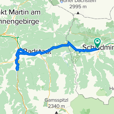
A cycling route starting in Schladming, Styria, Austria.
Overview
About this route
Eine landschaftlich wunderschöne, konditionell und technisch fordernde Radtour - nur für technisch versierte Biker!
Start Alpine Club Rohrmoos Die Auffahrt erfolgt erst Richtung Hochwurzen auf Aspahlt und geht dann in eine Schotterstraße (Mautstraße) über, zuerst gemütlich ansteigend, und wird dann zum PKW-Parkplatz immer steiler (Serpentinen; ~15% Steigung). Danach führt ein abschnittsweise noch steilerer Weg zu den Giglachseen. Mit dem höchsten Punkt (Ignaz-Mattis-Hütte = 1986m). Von dort geht es zuerst über Trails leicht fallend (kurze steilere Felsabschnitte ) bis kurz vor den Landauersee. Ab dort geht es über einen sehr steilen Traktorweg bergab bis zur Lackneralm wo man über einen Steg zu einem Wanderweg gelangt, der wiederum teilweise sehr steil, aber größtenteils fahrbar ins Obertal führt. Wenn man zur Wiese kommt kann man nach links abbiegen (Nickelmusem) und dort weiter talauswärts fahren. Wir haben bei der Hütte (Holdalm) eine Rast gemacht und sind von dort talauswärts gefahren. Bis man zur Untertalstraße gelangt, die man gleich direkt hinunterfahren kann um kurz vor der Kehre nach rechts gleich wieder links in einen Wanderweg einzubiegen. Dieser geht dann in einen kurzen Klammabschnitt (seitlich steil abfallend) über bis zum Etappenziel. Garmin: 37,8 km, 1.393 Hm- -:--
- Duration
- 38 km
- Distance
- 1,331 m
- Ascent
- 1,325 m
- Descent
- ---
- Avg. speed
- ---
- Max. altitude
Route highlights
Points of interest along the route

Point of interest after 4.6 km
Dachstein

Point of interest after 8.7 km
Beginn Mautstraße

Point of interest after 16.4 km
Serpentinen Mautstraße

Point of interest after 18.9 km
Blick zurück

Point of interest after 22.4 km
Alm
Continue with Bikemap
Use, edit, or download this cycling route
You would like to ride Giglachsee - Hopfriesen or customize it for your own trip? Here is what you can do with this Bikemap route:
Free features
- Save this route as favorite or in collections
- Copy & plan your own version of this route
- Sync your route with Garmin or Wahoo
Premium features
Free trial for 3 days, or one-time payment. More about Bikemap Premium.
- Navigate this route on iOS & Android
- Export a GPX / KML file of this route
- Create your custom printout (try it for free)
- Download this route for offline navigation
Discover more Premium features.
Get Bikemap PremiumFrom our community
Other popular routes starting in Schladming
 Planai
- Distance
- 17.9 km
- Ascent
- 1,105 m
- Descent
- 96 m
- Location
- Schladming, Styria, Austria
 MTB Runde. Ramsau - Hochwurzen - Fastenberg - Pichl - Ramsau
- Distance
- 53.3 km
- Ascent
- 1,912 m
- Descent
- 1,912 m
- Location
- Schladming, Styria, Austria
 Ennstalrunde
- Distance
- 67.7 km
- Ascent
- 608 m
- Descent
- 609 m
- Location
- Schladming, Styria, Austria
 Ramsau Tuerlwand
- Distance
- 32.8 km
- Ascent
- 1,350 m
- Descent
- 1,350 m
- Location
- Schladming, Styria, Austria
 Top 6 Schladming 08 medium
- Distance
- 47.4 km
- Ascent
- 1,654 m
- Descent
- 1,661 m
- Location
- Schladming, Styria, Austria
 Rakousko 2012-8.den-21.7.So
- Distance
- 29.6 km
- Ascent
- 274 m
- Descent
- 624 m
- Location
- Schladming, Styria, Austria
 Einrollen Ramsau 21.07.2014
- Distance
- 26.7 km
- Ascent
- 432 m
- Descent
- 432 m
- Location
- Schladming, Styria, Austria
 Schladming Flachau Rundweg
- Distance
- 61.3 km
- Ascent
- 224 m
- Descent
- 223 m
- Location
- Schladming, Styria, Austria
Open it in the app