

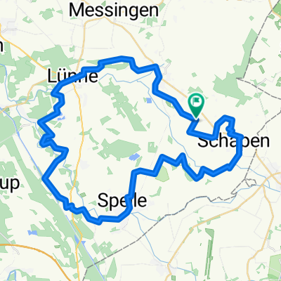
Schapen - Rheine
A cycling route starting in Schapen, Lower Saxony, Germany.
Overview
About this route
von Schapen über Dreierwalde nach Rheine, Dutumer Kotte
- -:--
- Duration
- 23.7 km
- Distance
- 28 m
- Ascent
- 17 m
- Descent
- ---
- Avg. speed
- ---
- Avg. speed
Route quality
Waytypes & surfaces along the route
Waytypes
Quiet road
15.3 km
(64 %)
Pedestrian area
2.2 km
(9 %)
Surfaces
Paved
12.2 km
(52 %)
Unpaved
0.6 km
(3 %)
Asphalt
7.5 km
(32 %)
Paved (undefined)
2.6 km
(11 %)
Continue with Bikemap
Use, edit, or download this cycling route
You would like to ride Schapen - Rheine or customize it for your own trip? Here is what you can do with this Bikemap route:
Free features
- Save this route as favorite or in collections
- Copy & plan your own version of this route
- Sync your route with Garmin or Wahoo
Premium features
Free trial for 3 days, or one-time payment. More about Bikemap Premium.
- Navigate this route on iOS & Android
- Export a GPX / KML file of this route
- Create your custom printout (try it for free)
- Download this route for offline navigation
Discover more Premium features.
Get Bikemap PremiumFrom our community
Other popular routes starting in Schapen
 Schapen - Rheine
- Distance
- 23.7 km
- Ascent
- 28 m
- Descent
- 17 m
- Location
- Schapen, Lower Saxony, Germany
 Tour2020
- Distance
- 15.9 km
- Ascent
- 32 m
- Descent
- 35 m
- Location
- Schapen, Lower Saxony, Germany
 Spelle Aatal-Moorroute
- Distance
- 46 km
- Ascent
- 66 m
- Descent
- 63 m
- Location
- Schapen, Lower Saxony, Germany
 Spelle_Aeatal-_und_Moor-Route - Spelle_Aeatal-_und_Moor-Route
- Distance
- 45.9 km
- Ascent
- 111 m
- Descent
- 112 m
- Location
- Schapen, Lower Saxony, Germany
 Spelle_Aeatal-_und_Moor-Route
- Distance
- 46.2 km
- Ascent
- 126 m
- Descent
- 126 m
- Location
- Schapen, Lower Saxony, Germany
 Schapen - Hof Lah
- Distance
- 10.1 km
- Ascent
- 21 m
- Descent
- 17 m
- Location
- Schapen, Lower Saxony, Germany
 Maennertour Schapen-Emsflower
- Distance
- 30.5 km
- Ascent
- 49 m
- Descent
- 58 m
- Location
- Schapen, Lower Saxony, Germany
 Töddenland Radweg
- Distance
- 123.4 km
- Ascent
- 544 m
- Descent
- 548 m
- Location
- Schapen, Lower Saxony, Germany
Open it in the app