

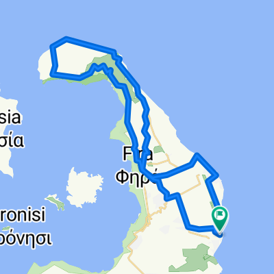
Vothonas- Kamari- Fira- Pirgos-Emporio
A cycling route starting in Messaria, South Aegean, Greece.
Overview
About this route
A very nice route
(cloned from route 1337150)
- -:--
- Duration
- 33.2 km
- Distance
- 525 m
- Ascent
- 525 m
- Descent
- ---
- Avg. speed
- ---
- Max. altitude
Route quality
Waytypes & surfaces along the route
Waytypes
Quiet road
11.3 km
(34 %)
Road
4.7 km
(14 %)
Surfaces
Paved
18.3 km
(55 %)
Unpaved
0.7 km
(2 %)
Asphalt
13 km
(39 %)
Paved (undefined)
4.3 km
(13 %)
Continue with Bikemap
Use, edit, or download this cycling route
You would like to ride Vothonas- Kamari- Fira- Pirgos-Emporio or customize it for your own trip? Here is what you can do with this Bikemap route:
Free features
- Save this route as favorite or in collections
- Copy & plan your own version of this route
- Sync your route with Garmin or Wahoo
Premium features
Free trial for 3 days, or one-time payment. More about Bikemap Premium.
- Navigate this route on iOS & Android
- Export a GPX / KML file of this route
- Create your custom printout (try it for free)
- Download this route for offline navigation
Discover more Premium features.
Get Bikemap PremiumFrom our community
Other popular routes starting in Messaria
 SANTORIN Rundfahrt Nähe Hafen
- Distance
- 15.7 km
- Ascent
- 270 m
- Descent
- 273 m
- Location
- Messaria, South Aegean, Greece
 THE GIANT SANTORINI ROUTE
- Distance
- 85.2 km
- Ascent
- 1,060 m
- Descent
- 1,060 m
- Location
- Messaria, South Aegean, Greece
 Vothonas- Kamari- Fira- Pirgos-Emporio
- Distance
- 33.9 km
- Ascent
- 540 m
- Descent
- 540 m
- Location
- Messaria, South Aegean, Greece
 Μεσσαριά-αεροδρόμιο- Καμάρι-Μεσσαριά Σαντορίνη
- Distance
- 4.3 km
- Ascent
- 114 m
- Descent
- 9 m
- Location
- Messaria, South Aegean, Greece
 Vothonas- Kamari- Fira- Pirgos-Emporio
- Distance
- 33.2 km
- Ascent
- 525 m
- Descent
- 525 m
- Location
- Messaria, South Aegean, Greece
 Pirgos Perissa Santorinibikes! Easy Downhill
- Distance
- 9.9 km
- Ascent
- 8 m
- Descent
- 322 m
- Location
- Messaria, South Aegean, Greece
 VERY EASY ROUTE
- Distance
- 12.5 km
- Ascent
- 146 m
- Descent
- 146 m
- Location
- Messaria, South Aegean, Greece
 Santorini northern part
- Distance
- 42.7 km
- Ascent
- 582 m
- Descent
- 582 m
- Location
- Messaria, South Aegean, Greece
Open it in the app