

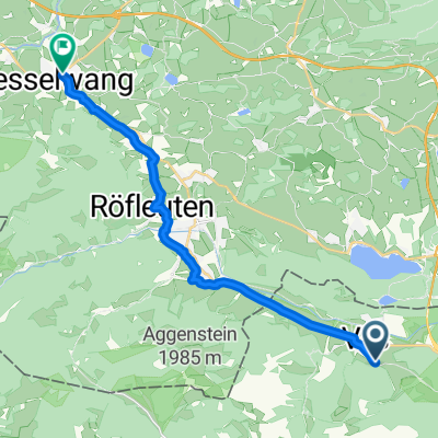
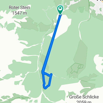
Ostler Hütte
A cycling route starting in Vils, Tyrol, Austria.
Overview
About this route
Initially on foot, finally by bike
- -:--
- Duration
- 10.7 km
- Distance
- 278 m
- Ascent
- 969 m
- Descent
- ---
- Avg. speed
- ---
- Max. altitude
Continue with Bikemap
Use, edit, or download this cycling route
You would like to ride Ostler Hütte or customize it for your own trip? Here is what you can do with this Bikemap route:
Free features
- Save this route as favorite or in collections
- Copy & plan your own version of this route
- Sync your route with Garmin or Wahoo
Premium features
Free trial for 3 days, or one-time payment. More about Bikemap Premium.
- Navigate this route on iOS & Android
- Export a GPX / KML file of this route
- Create your custom printout (try it for free)
- Download this route for offline navigation
Discover more Premium features.
Get Bikemap PremiumFrom our community
Other popular routes starting in Vils
 47.543, 10.637 nach 47.625, 10.503
- Distance
- 16.3 km
- Ascent
- 218 m
- Descent
- 191 m
- Location
- Vils, Tyrol, Austria
 Vils Bach Tour
- Distance
- 45.8 km
- Ascent
- 376 m
- Descent
- 347 m
- Location
- Vils, Tyrol, Austria
 Stegen-Heiterwanger See
- Distance
- 20 km
- Ascent
- 305 m
- Descent
- 143 m
- Location
- Vils, Tyrol, Austria
 Ettape3
- Distance
- 111.2 km
- Ascent
- 1,567 m
- Descent
- 1,473 m
- Location
- Vils, Tyrol, Austria
 Otto Mayr Hütte
- Distance
- 14.1 km
- Ascent
- 802 m
- Descent
- 97 m
- Location
- Vils, Tyrol, Austria
 Fallweg nach Fallweg
- Distance
- 6.4 km
- Ascent
- 421 m
- Descent
- 186 m
- Location
- Vils, Tyrol, Austria
 Hohenschwangau Hopfensee Burgenrunde
- Distance
- 44.3 km
- Ascent
- 318 m
- Descent
- 297 m
- Location
- Vils, Tyrol, Austria
 Weißensee-Falkenstein
- Distance
- 17 km
- Ascent
- 557 m
- Descent
- 512 m
- Location
- Vils, Tyrol, Austria
Open it in the app