

Faaker See - Anna Hütte
A cycling route starting in Wernberg, Carinthia, Austria.
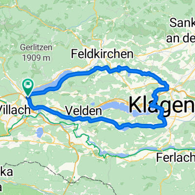
Overview
About this route
Schöne Tour zur Annahütte, zunächst moderate Steigungen bis (fast) zum Baumgartner Hof, danach etwas steiler und ca. die letzten 200 Hm noch etwas steiler, aber mit etwas Kondition zu bewältigen. Die Annahütte ist nicht mehr vorhanden (abgebrannt laut Karte), jedoch ist oben ein schöner Jausenplatz mit herrlicher Aussicht auf den Faaker See bzw. ein Stück weiter unten auch auf den Drau Stausee. Gesamte Höhenmeter Aufstieg laut Garmin GPS: 1345 Hm (Berechnung bikemap.net stimmt nicht).
- -:--
- Duration
- 40.1 km
- Distance
- 1,126 m
- Ascent
- 1,130 m
- Descent
- ---
- Avg. speed
- ---
- Avg. speed

Route quality
Waytypes & surfaces along the route
Waytypes
Track
18.2 km
(45 %)
Quiet road
15.6 km
(39 %)
Surfaces
Paved
19 km
(47 %)
Unpaved
17.9 km
(45 %)
Asphalt
19 km
(47 %)
Gravel
17.1 km
(43 %)
Continue with Bikemap
Use, edit, or download this cycling route
You would like to ride Faaker See - Anna Hütte or customize it for your own trip? Here is what you can do with this Bikemap route:
Free features
- Save this route as favorite or in collections
- Copy & plan your own version of this route
- Sync your route with Garmin or Wahoo
Premium features
Free trial for 3 days, or one-time payment. More about Bikemap Premium.
- Navigate this route on iOS & Android
- Export a GPX / KML file of this route
- Create your custom printout (try it for free)
- Download this route for offline navigation
Discover more Premium features.
Get Bikemap PremiumFrom our community
Other popular routes starting in Wernberg
 KärtnerSeen-1.Etappe
- Distance
- 34.7 km
- Ascent
- 90 m
- Descent
- 227 m
- Location
- Wernberg, Carinthia, Austria
 22. Gerlizen Bergtour
- Distance
- 47.1 km
- Ascent
- 1,574 m
- Descent
- 1,574 m
- Location
- Wernberg, Carinthia, Austria
 KäS1: Villach-Millstatt; 68,6km 510hm
- Distance
- 68.6 km
- Ascent
- 748 m
- Descent
- 631 m
- Location
- Wernberg, Carinthia, Austria
 Strandbadstraße, Villach nach Korzo, Rijeka
- Distance
- 328.2 km
- Ascent
- 6,875 m
- Descent
- 7,428 m
- Location
- Wernberg, Carinthia, Austria
 MTB-Flach: Ossiachersee/Annenheim - Drauradweg (Rosental)
- Distance
- 31.3 km
- Ascent
- 136 m
- Descent
- 170 m
- Location
- Wernberg, Carinthia, Austria
 Kärntner Seenrunde
- Distance
- 83.3 km
- Ascent
- 909 m
- Descent
- 915 m
- Location
- Wernberg, Carinthia, Austria
 🚴♀️E*Bike🇦🇹 Villach-Klagenfurt-Völkermarkt (Alternative)
- Distance
- 71 km
- Ascent
- 325 m
- Descent
- 387 m
- Location
- Wernberg, Carinthia, Austria
 Faaker See - Wörthersee
- Distance
- 43.8 km
- Ascent
- 329 m
- Descent
- 325 m
- Location
- Wernberg, Carinthia, Austria
Open it in the app