

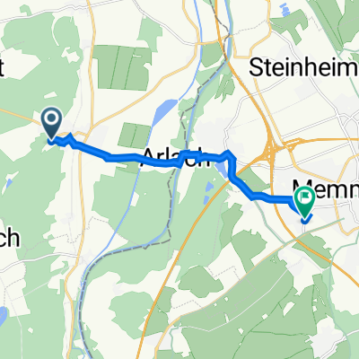
zum Staudacher Weiher
A cycling route starting in Tannheim, Baden-Wurttemberg, Germany.
Overview
About this route
Do I still want to ride?
- -:--
- Duration
- 47.6 km
- Distance
- 239 m
- Ascent
- 200 m
- Descent
- ---
- Avg. speed
- ---
- Max. altitude
Route quality
Waytypes & surfaces along the route
Waytypes
Road
10.9 km
(23 %)
Quiet road
2.4 km
(5 %)
Surfaces
Paved
32.8 km
(69 %)
Unpaved
3.8 km
(8 %)
Asphalt
31.9 km
(67 %)
Gravel
2.9 km
(6 %)
Continue with Bikemap
Use, edit, or download this cycling route
You would like to ride zum Staudacher Weiher or customize it for your own trip? Here is what you can do with this Bikemap route:
Free features
- Save this route as favorite or in collections
- Copy & plan your own version of this route
- Sync your route with Garmin or Wahoo
Premium features
Free trial for 3 days, or one-time payment. More about Bikemap Premium.
- Navigate this route on iOS & Android
- Export a GPX / KML file of this route
- Create your custom printout (try it for free)
- Download this route for offline navigation
Discover more Premium features.
Get Bikemap PremiumFrom our community
Other popular routes starting in Tannheim
 Von Haslach nach Kempten
- Distance
- 52.6 km
- Ascent
- 376 m
- Descent
- 353 m
- Location
- Tannheim, Baden-Wurttemberg, Germany
 Tannheim - Memingen - Volkratshofen - Ferthofen - Illerbrücke - Tannheim
- Distance
- 25.6 km
- Ascent
- 100 m
- Descent
- 102 m
- Location
- Tannheim, Baden-Wurttemberg, Germany
 Haslacher Straße 17, Tannheim nach Hühnerbergstraße 13, Memmingen
- Distance
- 8.3 km
- Ascent
- 83 m
- Descent
- 70 m
- Location
- Tannheim, Baden-Wurttemberg, Germany
 Kempten
- Distance
- 52.9 km
- Ascent
- 404 m
- Descent
- 376 m
- Location
- Tannheim, Baden-Wurttemberg, Germany
 Tannheim - Sinningen (inkl. Wildschweinpark)
- Distance
- 52.1 km
- Ascent
- 197 m
- Descent
- 195 m
- Location
- Tannheim, Baden-Wurttemberg, Germany
 Rottalrunde
- Distance
- 40.2 km
- Ascent
- 261 m
- Descent
- 261 m
- Location
- Tannheim, Baden-Wurttemberg, Germany
 Tannheim > Langenargen
- Distance
- 79 km
- Ascent
- 324 m
- Descent
- 507 m
- Location
- Tannheim, Baden-Wurttemberg, Germany
 100km Tannheim (Württ.) KE Eschach Kreuzthal Badsee (und immer dem Regen entkommen) (KTM)
- Distance
- 99.9 km
- Ascent
- 993 m
- Descent
- 1,034 m
- Location
- Tannheim, Baden-Wurttemberg, Germany
Open it in the app