

föhren
A cycling route starting in Föhren, Rhineland-Palatinate, Germany.
Overview
About this route
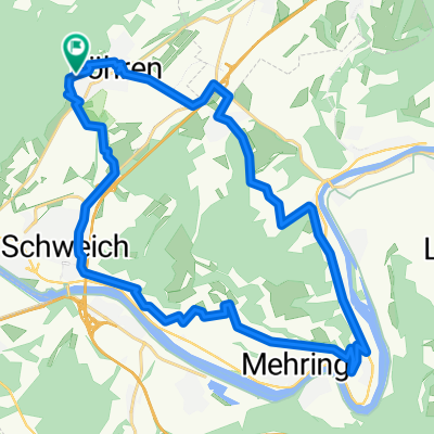
Föhren
Bekond (MTB Trail)
Ayers Rock
Hetzerath
- -:--
- Duration
- 21.1 km
- Distance
- 316 m
- Ascent
- 314 m
- Descent
- ---
- Avg. speed
- ---
- Max. altitude
Continue with Bikemap
Use, edit, or download this cycling route
You would like to ride föhren or customize it for your own trip? Here is what you can do with this Bikemap route:
Free features
- Save this route as favorite or in collections
- Copy & plan your own version of this route
- Sync your route with Garmin or Wahoo
Premium features
Free trial for 3 days, or one-time payment. More about Bikemap Premium.
- Navigate this route on iOS & Android
- Export a GPX / KML file of this route
- Create your custom printout (try it for free)
- Download this route for offline navigation
Discover more Premium features.
Get Bikemap PremiumFrom our community
Other popular routes starting in Föhren
 R01
R01- Distance
- 28.6 km
- Ascent
- 370 m
- Descent
- 370 m
- Location
- Föhren, Rhineland-Palatinate, Germany
 Ausfahrt vom 23. April 14:14
- Distance
- 20.2 km
- Ascent
- 153 m
- Descent
- 157 m
- Location
- Föhren, Rhineland-Palatinate, Germany
 Föhren - Rom
- Distance
- 1,428.2 km
- Ascent
- 14,043 m
- Descent
- 14,235 m
- Location
- Föhren, Rhineland-Palatinate, Germany
 föhren
- Distance
- 21.1 km
- Ascent
- 316 m
- Descent
- 314 m
- Location
- Föhren, Rhineland-Palatinate, Germany
 Wanderung Meulenwald
- Distance
- 10.5 km
- Ascent
- 289 m
- Descent
- 287 m
- Location
- Föhren, Rhineland-Palatinate, Germany
 Teil des Halbmarathon Schweich
- Distance
- 15.2 km
- Ascent
- 554 m
- Descent
- 557 m
- Location
- Föhren, Rhineland-Palatinate, Germany
 Meulenwald Föhren-Dierscheid-Heidweiler-MOB-Föhren
- Distance
- 26.1 km
- Ascent
- 499 m
- Descent
- 495 m
- Location
- Föhren, Rhineland-Palatinate, Germany
 Föhren-Naurath-Dierscheid
- Distance
- 16.8 km
- Ascent
- 347 m
- Descent
- 345 m
- Location
- Föhren, Rhineland-Palatinate, Germany
Open it in the app