

Heimrunde lang II
A cycling route starting in Tönisvorst, North Rhine-Westphalia, Germany.
Overview
About this route
None (cloned from route 850127)
(cloned from route 2257567)- -:--
- Duration
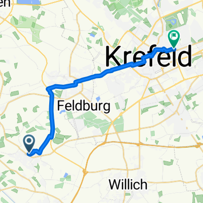
- 105.9 km
- Distance
- 131 m
- Ascent
- 131 m
- Descent
- ---
- Avg. speed
- ---
- Max. altitude
Route quality
Waytypes & surfaces along the route
Waytypes
Path
37.1 km
(35 %)
Road
13.8 km
(13 %)
Surfaces
Paved
87.9 km
(83 %)
Unpaved
6.4 km
(6 %)
Asphalt
86.8 km
(82 %)
Loose gravel
2.1 km
(2 %)
Continue with Bikemap
Use, edit, or download this cycling route
You would like to ride Heimrunde lang II or customize it for your own trip? Here is what you can do with this Bikemap route:
Free features
- Save this route as favorite or in collections
- Copy & plan your own version of this route
- Split it into stages to create a multi-day tour
- Sync your route with Garmin or Wahoo
Premium features
Free trial for 3 days, or one-time payment. More about Bikemap Premium.
- Navigate this route on iOS & Android
- Export a GPX / KML file of this route
- Create your custom printout (try it for free)
- Download this route for offline navigation
Discover more Premium features.
Get Bikemap PremiumFrom our community
Other popular routes starting in Tönisvorst
 120km Niederrhein
- Distance
- 116.3 km
- Ascent
- 99 m
- Descent
- 100 m
- Location
- Tönisvorst, North Rhine-Westphalia, Germany
 Rund um Hüls
- Distance
- 24 km
- Ascent
- 53 m
- Descent
- 53 m
- Location
- Tönisvorst, North Rhine-Westphalia, Germany
 Radmarathon durch KR und VIE
- Distance
- 50.2 km
- Ascent
- 34 m
- Descent
- 35 m
- Location
- Tönisvorst, North Rhine-Westphalia, Germany
 Sankt Tönis-Klixdorf-Ziegelheide-Kempen-Sankt Tönis
- Distance
- 29.7 km
- Ascent
- 12 m
- Descent
- 14 m
- Location
- Tönisvorst, North Rhine-Westphalia, Germany
 Kleiner und Großer De Wittsee – Bahntrasse Runde von Forsthaus
- Distance
- 64.3 km
- Ascent
- 122 m
- Descent
- 125 m
- Location
- Tönisvorst, North Rhine-Westphalia, Germany
 Route Richtung Oedt, Graverdyk See
- Distance
- 17.1 km
- Ascent
- 6 m
- Descent
- 8 m
- Location
- Tönisvorst, North Rhine-Westphalia, Germany
 Zur Dienststelle
- Distance
- 14.4 km
- Ascent
- 10 m
- Descent
- 12 m
- Location
- Tönisvorst, North Rhine-Westphalia, Germany
 Hülser Berg
- Distance
- 27.5 km
- Ascent
- 59 m
- Descent
- 59 m
- Location
- Tönisvorst, North Rhine-Westphalia, Germany
Open it in the app