

Final_Stolberg_Wernigerode_Harzburg
A cycling route starting in Stolberg, Saxony-Anhalt, Germany.
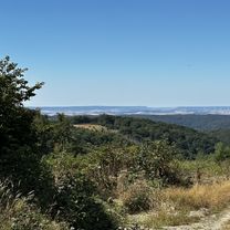
Overview
About this route
Final_letzter Tag
(cloned from route 2084910)- -:--
- Duration
- 93.2 km
- Distance
- 796 m
- Ascent
- 1,013 m
- Descent
- ---
- Avg. speed
- ---
- Max. altitude

Route quality
Waytypes & surfaces along the route
Waytypes
Busy road
69.8 km
(75 %)
Path
8.8 km
(9 %)
Surfaces
Paved
80.4 km
(86 %)
Unpaved
1 km
(1 %)
Asphalt
75.4 km
(81 %)
Paving stones
5 km
(5 %)
Continue with Bikemap
Use, edit, or download this cycling route
You would like to ride Final_Stolberg_Wernigerode_Harzburg or customize it for your own trip? Here is what you can do with this Bikemap route:
Free features
- Save this route as favorite or in collections
- Copy & plan your own version of this route
- Split it into stages to create a multi-day tour
- Sync your route with Garmin or Wahoo
Premium features
Free trial for 3 days, or one-time payment. More about Bikemap Premium.
- Navigate this route on iOS & Android
- Export a GPX / KML file of this route
- Create your custom printout (try it for free)
- Download this route for offline navigation
Discover more Premium features.
Get Bikemap PremiumFrom our community
Other popular routes starting in Stolberg
 MMIRunde2014
- Distance
- 51.6 km
- Ascent
- 558 m
- Descent
- 558 m
- Location
- Stolberg, Saxony-Anhalt, Germany
 Auf der Höhe, Südharz nach Auf der Höhe, Südharz
- Distance
- 13.4 km
- Ascent
- 196 m
- Descent
- 195 m
- Location
- Stolberg, Saxony-Anhalt, Germany
 2.Etappe Stolberg_Stolberg
- Distance
- 116.8 km
- Ascent
- 1,019 m
- Descent
- 1,019 m
- Location
- Stolberg, Saxony-Anhalt, Germany
 Final_Stolberg_Wernigerode_Harzburg
- Distance
- 93.2 km
- Ascent
- 796 m
- Descent
- 1,013 m
- Location
- Stolberg, Saxony-Anhalt, Germany
 W_Harz02_Alexisbad_Stolberg
- Distance
- 25.6 km
- Ascent
- 674 m
- Descent
- 642 m
- Location
- Stolberg, Saxony-Anhalt, Germany
 Schindelbr. Schweda Runde
- Distance
- 17.9 km
- Ascent
- 400 m
- Descent
- 400 m
- Location
- Stolberg, Saxony-Anhalt, Germany
 Breitenstein - Stolberg - Josephskreuz
- Distance
- 37.1 km
- Ascent
- 523 m
- Descent
- 527 m
- Location
- Stolberg, Saxony-Anhalt, Germany
 Stolberg Wippra Falkenstein
- Distance
- 85.6 km
- Ascent
- 698 m
- Descent
- 788 m
- Location
- Stolberg, Saxony-Anhalt, Germany
Open it in the app