

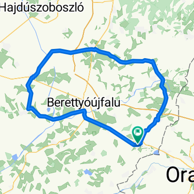
Biharkeresztes - Berettyóújfalu - Biharkeresztes
A cycling route starting in Biharkeresztes, Hajdú-Bihar, Hungary.
Overview
About this route
Biharkeresztes - Berettyóújfalu - Biharkeresztes
- -:--
- Duration
- 65.7 km
- Distance
- 16 m
- Ascent
- 18 m
- Descent
- ---
- Avg. speed
- ---
- Max. altitude
Route quality
Waytypes & surfaces along the route
Waytypes
Track
13.1 km
(20 %)
Quiet road
9.2 km
(14 %)
Surfaces
Paved
28.9 km
(44 %)
Unpaved
2 km
(3 %)
Asphalt
28.9 km
(44 %)
Gravel
2 km
(3 %)
Undefined
34.8 km
(53 %)
Continue with Bikemap
Use, edit, or download this cycling route
You would like to ride Biharkeresztes - Berettyóújfalu - Biharkeresztes or customize it for your own trip? Here is what you can do with this Bikemap route:
Free features
- Save this route as favorite or in collections
- Copy & plan your own version of this route
- Sync your route with Garmin or Wahoo
Premium features
Free trial for 3 days, or one-time payment. More about Bikemap Premium.
- Navigate this route on iOS & Android
- Export a GPX / KML file of this route
- Create your custom printout (try it for free)
- Download this route for offline navigation
Discover more Premium features.
Get Bikemap PremiumFrom our community
Other popular routes starting in Biharkeresztes
 Biharkeresztes - Zsáka - Komádi - Biharkeresztes
- Distance
- 75.9 km
- Ascent
- 18 m
- Descent
- 20 m
- Location
- Biharkeresztes, Hajdú-Bihar, Hungary
 Biharkeresztes - Berettyóújfalu - Biharkeresztes
- Distance
- 65.7 km
- Ascent
- 16 m
- Descent
- 18 m
- Location
- Biharkeresztes, Hajdú-Bihar, Hungary
 Biharkeresztes - Borszeg - Biharkeresztes
- Distance
- 96.1 km
- Ascent
- 503 m
- Descent
- 504 m
- Location
- Biharkeresztes, Hajdú-Bihar, Hungary
 Tekerj Erdélybe! Negyedik túra: Boga-völgye, Pádis
- Distance
- 168.5 km
- Ascent
- 1,809 m
- Descent
- 753 m
- Location
- Biharkeresztes, Hajdú-Bihar, Hungary
 Királyerdő(Padure Craiului) by PADCLIMBER From Biharkeresztes to Kötegyán
- Distance
- 387 km
- Ascent
- 8,129 m
- Descent
- 8,139 m
- Location
- Biharkeresztes, Hajdú-Bihar, Hungary
 Bk - Bu - Sáp - Derecske - Konyár - Bk
- Distance
- 104.9 km
- Ascent
- 20 m
- Descent
- 20 m
- Location
- Biharkeresztes, Hajdú-Bihar, Hungary
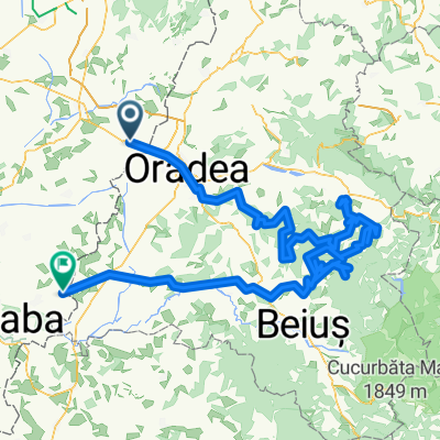
 Apuseni Mountains/Erdélyi-középhegység, cycling
- Distance
- 395.8 km
- Ascent
- 7,019 m
- Descent
- 7,020 m
- Location
- Biharkeresztes, Hajdú-Bihar, Hungary
 Bk - Bakonszeg - Füzesgyarmat - Nagyrábé - Bk
- Distance
- 106.4 km
- Ascent
- 24 m
- Descent
- 24 m
- Location
- Biharkeresztes, Hajdú-Bihar, Hungary
Open it in the app