

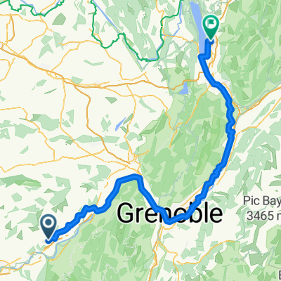
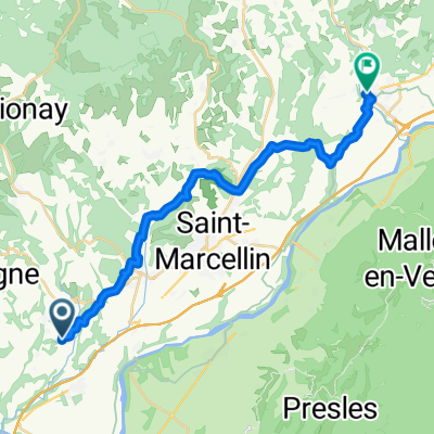
1872013
A cycling route starting in Saint-Hilaire-du-Rosier, Auvergne-Rhône-Alpes, France.
Overview
About this route
29-07-13 19:40
- -:--
- Duration
- 31.3 km
- Distance
- 1,680 m
- Ascent
- 1,677 m
- Descent
- ---
- Avg. speed
- ---
- Max. altitude
Continue with Bikemap
Use, edit, or download this cycling route
You would like to ride 1872013 or customize it for your own trip? Here is what you can do with this Bikemap route:
Free features
- Save this route as favorite or in collections
- Copy & plan your own version of this route
- Sync your route with Garmin or Wahoo
Premium features
Free trial for 3 days, or one-time payment. More about Bikemap Premium.
- Navigate this route on iOS & Android
- Export a GPX / KML file of this route
- Create your custom printout (try it for free)
- Download this route for offline navigation
Discover more Premium features.
Get Bikemap PremiumFrom our community
Other popular routes starting in Saint-Hilaire-du-Rosier
 Route du Furand nach Rue Jacotot
- Distance
- 154.4 km
- Ascent
- 903 m
- Descent
- 925 m
- Location
- Saint-Hilaire-du-Rosier, Auvergne-Rhône-Alpes, France
 1872013
- Distance
- 31.3 km
- Ascent
- 1,680 m
- Descent
- 1,677 m
- Location
- Saint-Hilaire-du-Rosier, Auvergne-Rhône-Alpes, France
 vercors
- Distance
- 153.3 km
- Ascent
- 2,965 m
- Descent
- 2,699 m
- Location
- Saint-Hilaire-du-Rosier, Auvergne-Rhône-Alpes, France
 2023 Agosto 4
- Distance
- 64.7 km
- Ascent
- 355 m
- Descent
- 377 m
- Location
- Saint-Hilaire-du-Rosier, Auvergne-Rhône-Alpes, France
 De Route du Furand 1985, Saint-Bonnet-de-Chavagne à Avenue Hippolyte Lhenry 16, Poisat
- Distance
- 64.3 km
- Ascent
- 580 m
- Descent
- 623 m
- Location
- Saint-Hilaire-du-Rosier, Auvergne-Rhône-Alpes, France
 Valence - Nizza 19.05.2014
- Distance
- 432.4 km
- Ascent
- 4,101 m
- Descent
- 4,053 m
- Location
- Saint-Hilaire-du-Rosier, Auvergne-Rhône-Alpes, France
 170507 vercors 9 cols
- Distance
- 131.2 km
- Ascent
- 1,999 m
- Descent
- 2,022 m
- Location
- Saint-Hilaire-du-Rosier, Auvergne-Rhône-Alpes, France
 Route du Furand nach Place de L Hôtel de ville
- Distance
- 23.8 km
- Ascent
- 390 m
- Descent
- 433 m
- Location
- Saint-Hilaire-du-Rosier, Auvergne-Rhône-Alpes, France
Open it in the app