
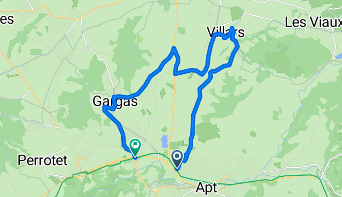
Itinéraire 1 Ocres: Plan d'eau, Villars, Gargas
A cycling route starting in Apt, Provence-Alpes-Côte d'Azur Region, France.
Overview
About this route
16.36 km
- -:--
- Duration
- 16.4 km
- Distance
- 166 m
- Ascent
- 193 m
- Descent
- ---
- Avg. speed
- ---
- Max. altitude
Route quality
Waytypes & surfaces along the route
Waytypes
Road
10.6 km
(65 %)
Quiet road
4.6 km
(28 %)
Undefined
1.1 km
(7 %)
Surfaces
Paved
8.3 km
(51 %)
Asphalt
8.3 km
(51 %)
Undefined
8 km
(49 %)
Continue with Bikemap
Use, edit, or download this cycling route
You would like to ride Itinéraire 1 Ocres: Plan d'eau, Villars, Gargas or customize it for your own trip? Here is what you can do with this Bikemap route:
Free features
- Save this route as favorite or in collections
- Copy & plan your own version of this route
- Sync your route with Garmin or Wahoo
Premium features
Free trial for 3 days, or one-time payment. More about Bikemap Premium.
- Navigate this route on iOS & Android
- Export a GPX / KML file of this route
- Create your custom printout (try it for free)
- Download this route for offline navigation
Discover more Premium features.
Get Bikemap PremiumFrom our community
Other popular routes starting in Apt
 6. Apt-Route Les Ocres a Veló-Apt
- Distance
- 44.7 km
- Ascent
- 638 m
- Descent
- 630 m
- Location
- Apt, Provence-Alpes-Côte d'Azur Region, France
 Apt-Gordes
- Distance
- 77.2 km
- Ascent
- 1,672 m
- Descent
- 1,658 m
- Location
- Apt, Provence-Alpes-Côte d'Azur Region, France
 F-Prov-Apt-Süd 45 500
- Distance
- 45.7 km
- Ascent
- 585 m
- Descent
- 586 m
- Location
- Apt, Provence-Alpes-Côte d'Azur Region, France
 Vacances - Murs Luberon
- Distance
- 19.4 km
- Ascent
- 386 m
- Descent
- 405 m
- Location
- Apt, Provence-Alpes-Côte d'Azur Region, France
 2010 06 29 - Apt
- Distance
- 68.2 km
- Ascent
- 744 m
- Descent
- 733 m
- Location
- Apt, Provence-Alpes-Côte d'Azur Region, France
 Saignon - 1000 hm
- Distance
- 39.6 km
- Ascent
- 983 m
- Descent
- 983 m
- Location
- Apt, Provence-Alpes-Côte d'Azur Region, France
 Luberon, Ocre par l'est, Moyenne boucle
- Distance
- 123.2 km
- Ascent
- 1,221 m
- Descent
- 1,221 m
- Location
- Apt, Provence-Alpes-Côte d'Azur Region, France
 VTT autour du Colorado Provençal
- Distance
- 22.7 km
- Ascent
- 526 m
- Descent
- 524 m
- Location
- Apt, Provence-Alpes-Côte d'Azur Region, France
Open it in the app