Cedar Rapids East - Short Ride with 3 Hills
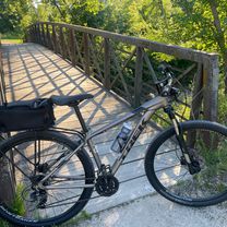
A cycling route starting in Cedar Rapids, Iowa, United States of America.
Overview
About this route
A short ride east on the eastern part of Cedar Rapids. There are three decent hills along this route. Traffic can be moderate, but a lot of the route has a decent shoulder
- -:--
- Duration
- 22.2 km
- Distance
- 202 m
- Ascent
- 202 m
- Descent
- ---
- Avg. speed
- ---
- Avg. speed
Route quality
Waytypes & surfaces along the route
Waytypes
Busy road
12.3 km
(55 %)
Quiet road
5.1 km
(23 %)
Surfaces
Paved
4.9 km
(22 %)
Unpaved
3 km
(14 %)
Asphalt
3.5 km
(16 %)
Gravel
3 km
(14 %)
Continue with Bikemap
Use, edit, or download this cycling route
You would like to ride Cedar Rapids East - Short Ride with 3 Hills or customize it for your own trip? Here is what you can do with this Bikemap route:
Free features
- Save this route as favorite or in collections
- Copy & plan your own version of this route
- Sync your route with Garmin or Wahoo
Premium features
Free trial for 3 days, or one-time payment. More about Bikemap Premium.
- Navigate this route on iOS & Android
- Export a GPX / KML file of this route
- Create your custom printout (try it for free)
- Download this route for offline navigation
Discover more Premium features.
Get Bikemap PremiumFrom our community
Other popular routes starting in Cedar Rapids
- Mount Vernon - Ely Iowa Loop
- Distance
- 82.3 km
- Ascent
- 282 m
- Descent
- 281 m
- Location
- Cedar Rapids, Iowa, United States of America
- Cedar Rapids East - Short Ride with 3 Hills
- Distance
- 22.2 km
- Ascent
- 202 m
- Descent
- 202 m
- Location
- Cedar Rapids, Iowa, United States of America
- 2508 23rd Ave SE, Cedar Rapids to 2377 Thompson St SE, Cedar Rapids
- Distance
- 24.3 km
- Ascent
- 125 m
- Descent
- 115 m
- Location
- Cedar Rapids, Iowa, United States of America
- Dead Beaver
- Distance
- 9.9 km
- Ascent
- 40 m
- Descent
- 45 m
- Location
- Cedar Rapids, Iowa, United States of America
- 2024 Corridor MPO Bike Ride
- Distance
- 24.6 km
- Ascent
- 115 m
- Descent
- 117 m
- Location
- Cedar Rapids, Iowa, United States of America
- Recovered Route
- Distance
- 32.1 km
- Ascent
- 111 m
- Descent
- 95 m
- Location
- Cedar Rapids, Iowa, United States of America
- A Street, Cedar Rapids to A Street, Cedar Rapids
- Distance
- 25.4 km
- Ascent
- 119 m
- Descent
- 122 m
- Location
- Cedar Rapids, Iowa, United States of America
- Solon to CR on the Trail
- Distance
- 23.9 km
- Ascent
- 137 m
- Descent
- 126 m
- Location
- Cedar Rapids, Iowa, United States of America
Open it in the app