

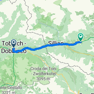
Dolomitenradweg Toblach - Calalzo
A cycling route starting in Toblach, Trentino-Alto Adige, Italy.
Overview
About this route
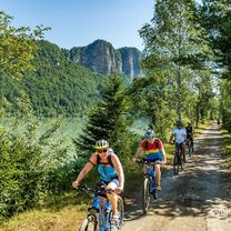
Very nice cycle path almost entirely downhill.
Actually, the cycle path starts in Toblach. But to avoid 400 m of elevation, you can also start at Dürrensee or Schluderbach. Parking at Dürrensee, then about 100 m of elevation to Cimabanche Pass.
At first partially gravelly, then fine gravel or paved.
Return with Dolomiti Bus. Departure from Calalzo train station. (Reservation) or organize the return with a bike shuttle (up to Toblach).
Exit by bus at Schluderbach (Carbonin).
The path is also quite well marked. Attention: In Acquabona, you are led away from the road down into the valley, then sent back up a gravel path in a 180° turn. (Narrow path parallel to the road going up)
- -:--
- Duration
- 65.4 km
- Distance
- 380 m
- Ascent
- 855 m
- Descent
- ---
- Avg. speed
- ---
- Max. altitude
Route highlights
Points of interest along the route

Point of interest after 7.9 km

Point of interest after 10.2 km

Point of interest after 10.8 km

Point of interest after 12.5 km

Point of interest after 14.3 km

Point of interest after 16.2 km

Point of interest after 17.8 km

Point of interest after 19.9 km

Point of interest after 31.6 km

Point of interest after 35.3 km

Point of interest after 38.5 km

Point of interest after 46.5 km

Point of interest after 49.6 km

Point of interest after 54.4 km

Point of interest after 60 km
Continue with Bikemap
Use, edit, or download this cycling route
You would like to ride Dolomitenradweg Toblach - Calalzo or customize it for your own trip? Here is what you can do with this Bikemap route:
Free features
- Save this route as favorite or in collections
- Copy & plan your own version of this route
- Sync your route with Garmin or Wahoo
Premium features
Free trial for 3 days, or one-time payment. More about Bikemap Premium.
- Navigate this route on iOS & Android
- Export a GPX / KML file of this route
- Create your custom printout (try it for free)
- Download this route for offline navigation
Discover more Premium features.
Get Bikemap PremiumFrom our community
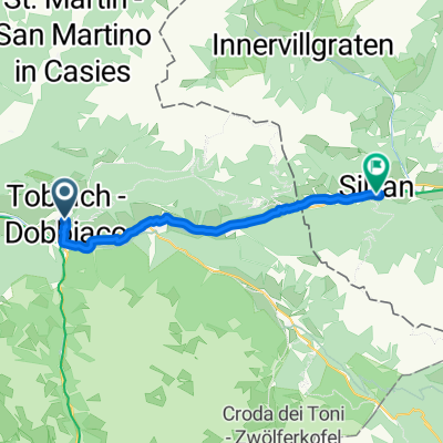
Other popular routes starting in Toblach
 DOBBIACO CORTINA
- Distance
- 70.6 km
- Ascent
- 845 m
- Descent
- 865 m
- Location
- Toblach, Trentino-Alto Adige, Italy
 Toblach - Anras
- Distance
- 27.7 km
- Ascent
- 152 m
- Descent
- 391 m
- Location
- Toblach, Trentino-Alto Adige, Italy
 Drava Cycle Route - Toblach to Aich/Dob
- Distance
- 288.3 km
- Ascent
- 2,961 m
- Descent
- 3,722 m
- Location
- Toblach, Trentino-Alto Adige, Italy
 Toblach - Cortina d'Ampezzo - Toblach
- Distance
- 63.9 km
- Ascent
- 685 m
- Descent
- 735 m
- Location
- Toblach, Trentino-Alto Adige, Italy
 Silvesterstraße nach Wahlen
- Distance
- 128.9 km
- Ascent
- 3,062 m
- Descent
- 3,137 m
- Location
- Toblach, Trentino-Alto Adige, Italy
 20.09.01 Toblach - Cortina d'Ampezzo
- Distance
- 32.2 km
- Ascent
- 337 m
- Descent
- 379 m
- Location
- Toblach, Trentino-Alto Adige, Italy
 Toblach - Abfaltersbach
- Distance
- 18.5 km
- Ascent
- 83 m
- Descent
- 238 m
- Location
- Toblach, Trentino-Alto Adige, Italy
 Viale Stazione, Dobbiaco a Amlacher Straße, Lienz
- Distance
- 49.2 km
- Ascent
- 107 m
- Descent
- 639 m
- Location
- Toblach, Trentino-Alto Adige, Italy
Open it in the app