

tannenberg-schwändi-mullern
A cycling route starting in Ennenda, Canton of Glarus, Switzerland.
Overview
About this route
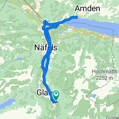
start in glarus richtung linthal bis haslen, tannenbergstrasse hoch bis nach skihaus, dann links weg über kiesstrasse bis aussichtsturm, links weg über kiesstrasse bis hinunter auf strasse dann runter bis schwanden. hoch nach schwändi und wieder hinunter nach glarus. hinüber nach ennetbühls, hoch bis ennetberge und weiter hoch bis naturfreundehaus (kurzes stück wanderweg schieben und tragen). strasse hinunter nach mollis und zurück nach glarus.
- -:--
- Duration
- 52.2 km
- Distance
- 1,606 m
- Ascent
- 1,607 m
- Descent
- ---
- Avg. speed
- ---
- Max. altitude

Continue with Bikemap
Use, edit, or download this cycling route
You would like to ride tannenberg-schwändi-mullern or customize it for your own trip? Here is what you can do with this Bikemap route:
Free features
- Save this route as favorite or in collections
- Copy & plan your own version of this route
- Sync your route with Garmin or Wahoo
Premium features
Free trial for 3 days, or one-time payment. More about Bikemap Premium.
- Navigate this route on iOS & Android
- Export a GPX / KML file of this route
- Create your custom printout (try it for free)
- Download this route for offline navigation
Discover more Premium features.
Get Bikemap PremiumFrom our community
Other popular routes starting in Ennenda
 Ennenda-Ziegelbrücke-Weesen-Flugplatz-Ennenda
- Distance
- 36.4 km
- Ascent
- 86 m
- Descent
- 86 m
- Location
- Ennenda, Canton of Glarus, Switzerland
 Glarus-Pfäffikon-Rappi-Glarus
- Distance
- 79.9 km
- Ascent
- 277 m
- Descent
- 277 m
- Location
- Ennenda, Canton of Glarus, Switzerland
 Klausen- Pragelpass
- Distance
- 128.4 km
- Ascent
- 2,711 m
- Descent
- 2,711 m
- Location
- Ennenda, Canton of Glarus, Switzerland
 Projekt 2014 Tag1
- Distance
- 63.5 km
- Ascent
- 1,537 m
- Descent
- 1,553 m
- Location
- Ennenda, Canton of Glarus, Switzerland
 glarus-filzbach-mühlehorn-niederurnen-glarus
- Distance
- 40.3 km
- Ascent
- 432 m
- Descent
- 432 m
- Location
- Ennenda, Canton of Glarus, Switzerland
 Glarus-Schwammhöchi
- Distance
- 8 km
- Ascent
- 621 m
- Descent
- 6 m
- Location
- Ennenda, Canton of Glarus, Switzerland
 hochzeitsrikscha
- Distance
- 4 km
- Ascent
- 13 m
- Descent
- 12 m
- Location
- Ennenda, Canton of Glarus, Switzerland
 Murgsee - Spanneggsee (VTT)
- Distance
- 5.1 km
- Ascent
- 297 m
- Descent
- 617 m
- Location
- Ennenda, Canton of Glarus, Switzerland
Open it in the app