

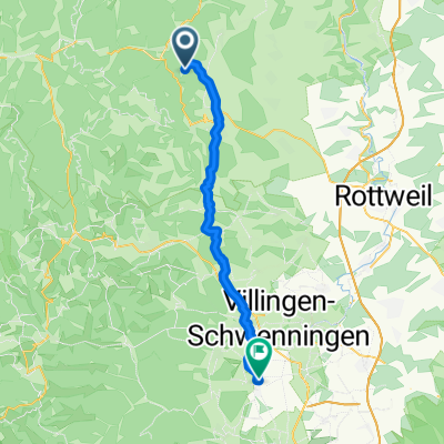
Schenkenzell-Schiltach-St.Roman und zurück
A cycling route starting in Schenkenzell, Baden-Wurttemberg, Germany.
Overview
About this route
From Schenkenzell, the path to Schiltach passes by the ruins of Schenkenburg. Now we go up the Kuhbach to the Kuhberg until we reach the Teisenkopf. Once there, you can enjoy the beautiful area around Schenkenzell from an observation tower. The view extends to the Swabian Alb. Afterwards, we continue via Salzlecke to St. Roman. The return route leads over Elmlisberg to the train station in Schiltach and from there back to Schenkenzell via Schenkenburg. 90% of the route is on forest paths.
- -:--
- Duration
- 31.6 km
- Distance
- 766 m
- Ascent
- 766 m
- Descent
- ---
- Avg. speed
- ---
- Max. altitude

Continue with Bikemap
Use, edit, or download this cycling route
You would like to ride Schenkenzell-Schiltach-St.Roman und zurück or customize it for your own trip? Here is what you can do with this Bikemap route:
Free features
- Save this route as favorite or in collections
- Copy & plan your own version of this route
- Sync your route with Garmin or Wahoo
Premium features
Free trial for 3 days, or one-time payment. More about Bikemap Premium.
- Navigate this route on iOS & Android
- Export a GPX / KML file of this route
- Create your custom printout (try it for free)
- Download this route for offline navigation
Discover more Premium features.
Get Bikemap PremiumFrom our community
Other popular routes starting in Schenkenzell
 Schenkenzell-Aichhalden-Schramberg
- Distance
- 28.6 km
- Ascent
- 605 m
- Descent
- 602 m
- Location
- Schenkenzell, Baden-Wurttemberg, Germany
 Götzenäcker nach Marktstraße
- Distance
- 94.6 km
- Ascent
- 1,325 m
- Descent
- 1,732 m
- Location
- Schenkenzell, Baden-Wurttemberg, Germany
 Schenkenzell-Kniebis-Lossburg
- Distance
- 68 km
- Ascent
- 1,834 m
- Descent
- 1,634 m
- Location
- Schenkenzell, Baden-Wurttemberg, Germany
 Schenkenzell-Nordrach und zurück
- Distance
- 101.3 km
- Ascent
- 1,014 m
- Descent
- 1,015 m
- Location
- Schenkenzell, Baden-Wurttemberg, Germany
 schiltach bubble n brigachtal
- Distance
- 38.7 km
- Ascent
- 677 m
- Descent
- 499 m
- Location
- Schenkenzell, Baden-Wurttemberg, Germany
 Schenkenzell-Hark Hof - die anstrengende
- Distance
- 82.3 km
- Ascent
- 953 m
- Descent
- 953 m
- Location
- Schenkenzell, Baden-Wurttemberg, Germany
 Schenkenzell-Schiltach-St.Roman und zurück
- Distance
- 31.6 km
- Ascent
- 766 m
- Descent
- 766 m
- Location
- Schenkenzell, Baden-Wurttemberg, Germany
 Schenkenzell-Hark Hof - die sanfte
- Distance
- 72.7 km
- Ascent
- 912 m
- Descent
- 911 m
- Location
- Schenkenzell, Baden-Wurttemberg, Germany
Open it in the app