

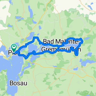
Plöner Seen Tour
A cycling route starting in Plön, Schleswig-Holstein, Germany.
Overview
About this route
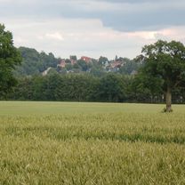
Very nice tour through the lake landscape around Plön. The paths are good to ride, and there are always places to rest. Along the way, you can often find a snack bar or a spot to swim in the lake. The constant change of forest, meadows, and lake makes the tour enjoyable. (Caution: Some sections lead over country roads, only partially suitable for children.)
- -:--
- Duration
- 67.4 km
- Distance
- 239 m
- Ascent
- 239 m
- Descent
- ---
- Avg. speed
- ---
- Max. altitude

Route highlights
Points of interest along the route
Point of interest after 51.9 km
Starker Anstieg !!
Point of interest after 56.1 km
Badestelle
Continue with Bikemap
Use, edit, or download this cycling route
You would like to ride Plöner Seen Tour or customize it for your own trip? Here is what you can do with this Bikemap route:
Free features
- Save this route as favorite or in collections
- Copy & plan your own version of this route
- Sync your route with Garmin or Wahoo
Premium features
Free trial for 3 days, or one-time payment. More about Bikemap Premium.
- Navigate this route on iOS & Android
- Export a GPX / KML file of this route
- Create your custom printout (try it for free)
- Download this route for offline navigation
Discover more Premium features.
Get Bikemap PremiumFrom our community
Other popular routes starting in Plön
 Plön/Malente
- Distance
- 38.6 km
- Ascent
- 171 m
- Descent
- 171 m
- Location
- Plön, Schleswig-Holstein, Germany
 Behl-Benz-Kaköhl-Hohwacht-Rantzau
- Distance
- 80.1 km
- Ascent
- 335 m
- Descent
- 334 m
- Location
- Plön, Schleswig-Holstein, Germany
 kleine Plönerseerunde
- Distance
- 37.3 km
- Ascent
- 177 m
- Descent
- 173 m
- Location
- Plön, Schleswig-Holstein, Germany
 Großer Plöner See
- Distance
- 37.2 km
- Ascent
- 203 m
- Descent
- 217 m
- Location
- Plön, Schleswig-Holstein, Germany
 Plön - Malente
- Distance
- 33.4 km
- Ascent
- 123 m
- Descent
- 121 m
- Location
- Plön, Schleswig-Holstein, Germany
 SH4: Städtchen Tour / Holsteinische Schweiz
- Distance
- 51.6 km
- Ascent
- 448 m
- Descent
- 447 m
- Location
- Plön, Schleswig-Holstein, Germany
 Plöner Seen Tour 70km
- Distance
- 69.1 km
- Ascent
- 464 m
- Descent
- 456 m
- Location
- Plön, Schleswig-Holstein, Germany
 Plön Malente
- Distance
- 40.8 km
- Ascent
- 137 m
- Descent
- 136 m
- Location
- Plön, Schleswig-Holstein, Germany
Open it in the app