

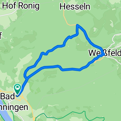
BBr - Andernach
A cycling route starting in Bad Hönningen, Rhineland-Palatinate, Germany.
Overview
About this route
- -:--
- Duration
- 11.6 km
- Distance
- 109 m
- Ascent
- 88 m
- Descent
- ---
- Avg. speed
- 106 m
- Max. altitude

Route quality
Waytypes & surfaces along the route
Waytypes
Quiet road
5.4 km
(46 %)
Path
3.6 km
(31 %)
Surfaces
Paved
7.3 km
(63 %)
Asphalt
7.3 km
(63 %)
Undefined
4.3 km
(37 %)
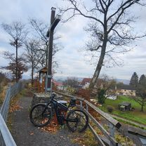
Route highlights
Points of interest along the route

Point of interest after 0 km
Rheinhotel 4-Jahreszeiten
Continue with Bikemap
Use, edit, or download this cycling route
You would like to ride BBr - Andernach or customize it for your own trip? Here is what you can do with this Bikemap route:
Free features
- Save this route as favorite or in collections
- Copy & plan your own version of this route
- Sync your route with Garmin or Wahoo
Premium features
Free trial for 3 days, or one-time payment. More about Bikemap Premium.
- Navigate this route on iOS & Android
- Export a GPX / KML file of this route
- Create your custom printout (try it for free)
- Download this route for offline navigation
Discover more Premium features.
Get Bikemap PremiumFrom our community
Other popular routes starting in Bad Hönningen
 Moorbachtal
- Distance
- 13.8 km
- Ascent
- 262 m
- Descent
- 311 m
- Location
- Bad Hönningen, Rhineland-Palatinate, Germany
 BBr - Andernach
- Distance
- 11.6 km
- Ascent
- 109 m
- Descent
- 88 m
- Location
- Bad Hönningen, Rhineland-Palatinate, Germany
 Limes 1
- Distance
- 148.3 km
- Ascent
- 2,007 m
- Descent
- 1,789 m
- Location
- Bad Hönningen, Rhineland-Palatinate, Germany
 deutscher Limes Radweg
- Distance
- 11.9 km
- Ascent
- 355 m
- Descent
- 63 m
- Location
- Bad Hönningen, Rhineland-Palatinate, Germany
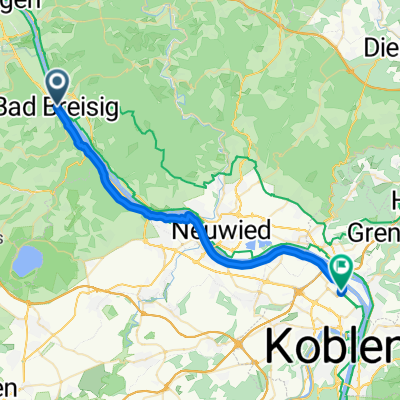 Rheinufer, Bad Breisig nach Hans-Böckler-Straße, Koblenz
- Distance
- 29.4 km
- Ascent
- 80 m
- Descent
- 68 m
- Location
- Bad Hönningen, Rhineland-Palatinate, Germany
 BBr - Basislager
- Distance
- 18.9 km
- Ascent
- 94 m
- Descent
- 48 m
- Location
- Bad Hönningen, Rhineland-Palatinate, Germany
 Bad Hönningen - Grube Louise
- Distance
- 24.2 km
- Ascent
- 757 m
- Descent
- 589 m
- Location
- Bad Hönningen, Rhineland-Palatinate, Germany
 Waldbreitbacher Straße nach Am Höms
- Distance
- 16.1 km
- Ascent
- 351 m
- Descent
- 394 m
- Location
- Bad Hönningen, Rhineland-Palatinate, Germany
Open it in the app