

Sumiyoshicho to Takahamaminato
A cycling route starting in Handa, Aichi, Japan.
Overview
About this route
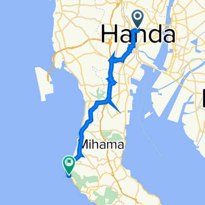
Sumiyoshicho to Takahamaminato (7.2km)
- -:--
- Duration
- 7.2 km
- Distance
- 20 m
- Ascent
- 17 m
- Descent
- ---
- Avg. speed
- ---
- Max. altitude
Continue with Bikemap
Use, edit, or download this cycling route
You would like to ride Sumiyoshicho to Takahamaminato or customize it for your own trip? Here is what you can do with this Bikemap route:
Free features
- Save this route as favorite or in collections
- Copy & plan your own version of this route
- Sync your route with Garmin or Wahoo
Premium features
Free trial for 3 days, or one-time payment. More about Bikemap Premium.
- Navigate this route on iOS & Android
- Export a GPX / KML file of this route
- Create your custom printout (try it for free)
- Download this route for offline navigation
Discover more Premium features.
Get Bikemap PremiumFrom our community
Other popular routes starting in Handa
 1_3_HANDA_GAMAGORI_38km_270m
- Distance
- 37.2 km
- Ascent
- 179 m
- Descent
- 186 m
- Location
- Handa, Aichi, Japan
 De 1-chōme, Handa a 1-chōme, Handa
- Distance
- 1.4 km
- Ascent
- 3 m
- Descent
- 0 m
- Location
- Handa, Aichi, Japan
 De 7-chōme, Handa a 1-chōme, Handa
- Distance
- 0.7 km
- Ascent
- 0 m
- Descent
- 24 m
- Location
- Handa, Aichi, Japan
 De Miyahiraike, Agui a 1-chōme, Handa
- Distance
- 3.3 km
- Ascent
- 23 m
- Descent
- 21 m
- Location
- Handa, Aichi, Japan
 De 5-chōme, Handa a 1-chōme, Handa
- Distance
- 32 km
- Ascent
- 186 m
- Descent
- 180 m
- Location
- Handa, Aichi, Japan
 Recovered Route
- Distance
- 26.1 km
- Ascent
- 186 m
- Descent
- 215 m
- Location
- Handa, Aichi, Japan
 3丁目, 半田市 まで2, 四日市市
- Distance
- 81.8 km
- Ascent
- 237 m
- Descent
- 242 m
- Location
- Handa, Aichi, Japan
 201-31, Hiiragicho 4-Chōme, Handa to Minamichita Road, Taketoyo, Chita-Gun
- Distance
- 8.7 km
- Ascent
- 213 m
- Descent
- 211 m
- Location
- Handa, Aichi, Japan
Open it in the app