Bergen Salzburg
- 49.4 km
- 316 m
- 455 m
- Bergen, Bavaria, Germany
A cycling route starting in Bergen, Bavaria, Germany.
Overview
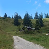
Start at the parking lot of the Hochfelln cable car in Bergen. The route is mostly on paved side roads or bike paths. From Urschlau over Rötelmoos to Oberwössen via gravel road (Forststraße) and closed to motor vehicles. Moderate inclines, except for the section to Kanonenpass (about 1 km very steep). Afterwards, partly strong downhill stretch on Forststraße to Oberwössen (OT Brem). From here, continuous asphalt up to the finish in Bergen.
(cloned from route 1162343)created this 12 years ago
Continue with Bikemap
You would like to ride Rund um den Hochfelln or customize it for your own trip? Here is what you can do with this Bikemap route:
Free trial for 3 days, or one-time payment. More about Bikemap Premium.
Discover more Premium features.
Get Bikemap PremiumFrom our community
Open it in the app