

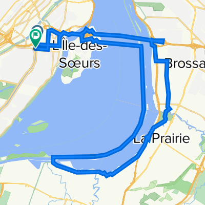
Parc Des Rapides
A cycling route starting in Saint-Raymond, Quebec, Canada.
Overview
About this route
2013-08-07 11:44
- -:--
- Duration
- 24.5 km
- Distance
- 34 m
- Ascent
- 34 m
- Descent
- ---
- Avg. speed
- ---
- Max. altitude
Route quality
Waytypes & surfaces along the route
Waytypes
Cycleway
21.8 km
(89 %)
Road
1 km
(4 %)
Surfaces
Paved
24 km
(98 %)
Asphalt
23.8 km
(97 %)
Concrete
0.2 km
(1 %)
Undefined
0.5 km
(2 %)
Continue with Bikemap
Use, edit, or download this cycling route
You would like to ride Parc Des Rapides or customize it for your own trip? Here is what you can do with this Bikemap route:
Free features
- Save this route as favorite or in collections
- Copy & plan your own version of this route
- Sync your route with Garmin or Wahoo
Premium features
Free trial for 3 days, or one-time payment. More about Bikemap Premium.
- Navigate this route on iOS & Android
- Export a GPX / KML file of this route
- Create your custom printout (try it for free)
- Download this route for offline navigation
Discover more Premium features.
Get Bikemap PremiumFrom our community
Other popular routes starting in Saint-Raymond
 Parc Des Rapides
- Distance
- 24.5 km
- Ascent
- 34 m
- Descent
- 34 m
- Location
- Saint-Raymond, Quebec, Canada
 Terence & Bud
- Distance
- 39.3 km
- Ascent
- 40 m
- Descent
- 46 m
- Location
- Saint-Raymond, Quebec, Canada
 Rue Notre-Dame Ouest 6272, Montréal to Rue Richmond 675, Montréal
- Distance
- 6.2 km
- Ascent
- 14 m
- Descent
- 82 m
- Location
- Saint-Raymond, Quebec, Canada
 Cracking ride in Montréal
- Distance
- 32.3 km
- Ascent
- 88 m
- Descent
- 144 m
- Location
- Saint-Raymond, Quebec, Canada
 Ste Anne de Bellevue, Senneville loop
- Distance
- 74.8 km
- Ascent
- 114 m
- Descent
- 114 m
- Location
- Saint-Raymond, Quebec, Canada
 Howick Loop
- Distance
- 154.2 km
- Ascent
- 139 m
- Descent
- 133 m
- Location
- Saint-Raymond, Quebec, Canada
 Montagne-ref
- Distance
- 18.5 km
- Ascent
- 386 m
- Descent
- 386 m
- Location
- Saint-Raymond, Quebec, Canada
 Verdun, St-Catherine, La Prairie
- Distance
- 41.5 km
- Ascent
- 112 m
- Descent
- 108 m
- Location
- Saint-Raymond, Quebec, Canada
Open it in the app