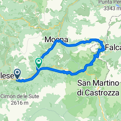
PanchiĆ 01 - Marmolada
A cycling route starting in PanchiĆ , Trentino-Alto Adige, Italy.
Overview
About this route
Partenza dall'Hotel Panorama per affrontare Valles e Fedaia
- -:--
- Duration
- 119.4 km
- Distance
- 2,320 m
- Ascent
- 2,320 m
- Descent
- ---
- Avg. speed
- ---
- Max. altitude
Continue with Bikemap
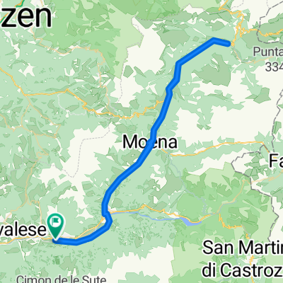
Use, edit, or download this cycling route
You would like to ride PanchiĆ 01 - Marmolada or customize it for your own trip? Here is what you can do with this Bikemap route:
Free features
- Save this route as favorite or in collections
- Copy & plan your own version of this route
- Split it into stages to create a multi-day tour
- Sync your route with Garmin or Wahoo
Premium features
Free trial for 3 days, or one-time payment. More about Bikemap Premium.
- Navigate this route on iOS & Android
- Export a GPX / KML file of this route
- Create your custom printout (try it for free)
- Download this route for offline navigation
Discover more Premium features.
Get Bikemap PremiumFrom our community
Other popular routes starting in PanchiĆ
- PanchiĆ 01 - Marmolada
- Distance
- 119.4 km
- Ascent
- 2,320 m
- Descent
- 2,320 m
- Location
- PanchiĆ , Trentino-Alto Adige, Italy
- 3.den 1.9.2014
- Distance
- 431.3 km
- Ascent
- 3,469 m
- Descent
- 3,224 m
- Location
- PanchiĆ , Trentino-Alto Adige, Italy
- Da Strada senza nome, Cavalese a Ziano di Fiemme
- Distance
- 210.9 km
- Ascent
- 9,615 m
- Descent
- 9,517 m
- Location
- PanchiĆ , Trentino-Alto Adige, Italy
- Dolomiti
- Distance
- 411.7 km
- Ascent
- 9,850 m
- Descent
- 9,850 m
- Location
- PanchiĆ , Trentino-Alto Adige, Italy
- giro iniziale
- Distance
- 1 km
- Ascent
- 4 m
- Descent
- 18 m
- Location
- PanchiĆ , Trentino-Alto Adige, Italy
- Prova Rando
- Distance
- 437.3 km
- Ascent
- 9,147 m
- Descent
- 8,284 m
- Location
- PanchiĆ , Trentino-Alto Adige, Italy
- Da Castello-Molina di Fiemme a Predazzo
- Distance
- 61.8 km
- Ascent
- 2,161 m
- Descent
- 2,055 m
- Location
- PanchiĆ , Trentino-Alto Adige, Italy
- Etappe5 Cavalese-Levico Terme 09.07.
- Distance
- 66.4 km
- Ascent
- 1,640 m
- Descent
- 2,010 m
- Location
- PanchiĆ , Trentino-Alto Adige, Italy
Open it in the app