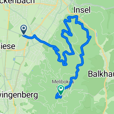
2013_2
A cycling route starting in Alsbach-Hähnlein, Hesse, Germany.
Overview
About this route
Alsbach Seeheim Pfungstadt
(cloned from route 2170478)- -:--
- Duration
- 21.6 km
- Distance
- 205 m
- Ascent
- 207 m
- Descent
- ---
- Avg. speed
- ---
- Avg. speed
Route quality
Waytypes & surfaces along the route
Waytypes
Busy road
7.4 km
(34 %)
Road
6.3 km
(29 %)
Surfaces
Paved
14 km
(65 %)
Unpaved
0 km
(<1 %)
Asphalt
13.8 km
(64 %)
Paved (undefined)
0.1 km
(<1 %)
Continue with Bikemap
Use, edit, or download this cycling route
You would like to ride 2013_2 or customize it for your own trip? Here is what you can do with this Bikemap route:
Free features
- Save this route as favorite or in collections
- Copy & plan your own version of this route
- Sync your route with Garmin or Wahoo
Premium features
Free trial for 3 days, or one-time payment. More about Bikemap Premium.
- Navigate this route on iOS & Android
- Export a GPX / KML file of this route
- Create your custom printout (try it for free)
- Download this route for offline navigation
Discover more Premium features.
Get Bikemap PremiumFrom our community
Other popular routes starting in Alsbach-Hähnlein
- 29.05.21
- Distance
- 15.7 km
- Ascent
- 141 m
- Descent
- 143 m
- Location
- Alsbach-Hähnlein, Hesse, Germany
- Melibokus - Felsenmeer - Schloss Auerbach - Bensheim-Auabach
- Distance
- 21.8 km
- Ascent
- 880 m
- Descent
- 880 m
- Location
- Alsbach-Hähnlein, Hesse, Germany
- Alsbach nach HĂśchst
- Distance
- 40.6 km
- Ascent
- 1,018 m
- Descent
- 941 m
- Location
- Alsbach-Hähnlein, Hesse, Germany
- Rheinhessenrundfahrt 1
- Distance
- 109.5 km
- Ascent
- 515 m
- Descent
- 513 m
- Location
- Alsbach-Hähnlein, Hesse, Germany
- E35, Alsbach-Hähnlein nach A5, Bensheim
- Distance
- 2.4 km
- Ascent
- 0 m
- Descent
- 0 m
- Location
- Alsbach-Hähnlein, Hesse, Germany
- 2013_2
- Distance
- 21.6 km
- Ascent
- 205 m
- Descent
- 207 m
- Location
- Alsbach-Hähnlein, Hesse, Germany
- Langwaden-Goddelau
- Distance
- 33.9 km
- Ascent
- 60 m
- Descent
- 55 m
- Location
- Alsbach-Hähnlein, Hesse, Germany
- Sandwiese - Alsbacher SchloĂ - Luciberg - Melibokus - Auerbacher SchloĂ - Kirchberg - Sandwiese
- Distance
- 36.2 km
- Ascent
- 899 m
- Descent
- 901 m
- Location
- Alsbach-Hähnlein, Hesse, Germany
Open it in the app