Kirchsee - Taubenberg - Thalham - Irschenberg - Parsberg - Miesbach
A cycling route starting in Sachsenkam, Bavaria, Germany.
Overview
About this route
Schöne Tour über das Hinterland. Nur kleine Strassen. Welliges Profil
- -:--
- Duration
- 68.3 km
- Distance
- 944 m
- Ascent
- 937 m
- Descent
- ---
- Avg. speed
- 808 m
- Avg. speed
Route quality
Waytypes & surfaces along the route
Waytypes
Quiet road
36 km
(53 %)
Road
22.8 km
(33 %)
Surfaces
Paved
60.2 km
(88 %)
Unpaved
0 km
(<1 %)
Asphalt
60.2 km
(88 %)
Sand
0 km
(<1 %)
Undefined
8 km
(12 %)
Continue with Bikemap
Use, edit, or download this cycling route
You would like to ride Kirchsee - Taubenberg - Thalham - Irschenberg - Parsberg - Miesbach or customize it for your own trip? Here is what you can do with this Bikemap route:
Free features
- Save this route as favorite or in collections
- Copy & plan your own version of this route
- Sync your route with Garmin or Wahoo
Premium features
Free trial for 3 days, or one-time payment. More about Bikemap Premium.
- Navigate this route on iOS & Android
- Export a GPX / KML file of this route
- Create your custom printout (try it for free)
- Download this route for offline navigation
Discover more Premium features.
Get Bikemap PremiumFrom our community
Other popular routes starting in Sachsenkam
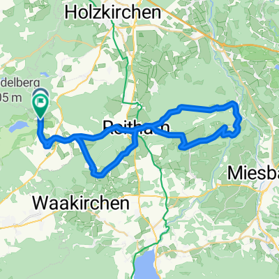
- Babenberg-Innsbruck loop
- Distance
- 373.6 km
- Ascent
- 1,405 m
- Descent
- 1,405 m
- Location
- Sachsenkam, Bavaria, Germany
- Kirchsee - Taubenberg - Thalham - Irschenberg - Parsberg - Miesbach
- Distance
- 68.3 km
- Ascent
- 944 m
- Descent
- 937 m
- Location
- Sachsenkam, Bavaria, Germany
- Kloster Reutberg to Bad Tölz and back via Kirchsee
- Distance
- 22 km
- Ascent
- 116 m
- Descent
- 117 m
- Location
- Sachsenkam, Bavaria, Germany
- Reutberg-Kirchsee-Ellbach Rundweg
- Distance
- 20.6 km
- Ascent
- 254 m
- Descent
- 257 m
- Location
- Sachsenkam, Bavaria, Germany
- taubenberg
- Distance
- 38.2 km
- Ascent
- 561 m
- Descent
- 521 m
- Location
- Sachsenkam, Bavaria, Germany
- Kirchsee Königsdorf über die schönsten Wiesen Oberbayerns
- Distance
- 60.7 km
- Ascent
- 383 m
- Descent
- 371 m
- Location
- Sachsenkam, Bavaria, Germany
- RC03 ObRunde 2 Gruppe C
- Distance
- 41.1 km
- Ascent
- 359 m
- Descent
- 359 m
- Location
- Sachsenkam, Bavaria, Germany
- SAC Walchensee Kochelsee SAC
- Distance
- 110.1 km
- Ascent
- 566 m
- Descent
- 573 m
- Location
- Sachsenkam, Bavaria, Germany
Open it in the app