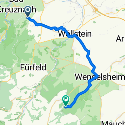
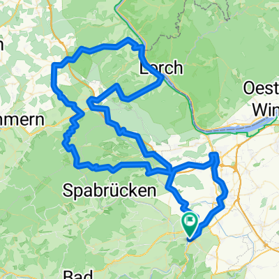
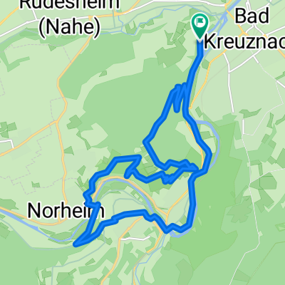
Saarland 2: Bad Kreuznach - B420 - Illingen/Saar
A cycling route starting in Bad Kreuznach, Rhineland-Palatinate, Germany.
Overview
About this route
<p>How do I get from Bad Kreuznach to Illingen/Saar - Part 2</p>
<p>KH - Bad Münster am Stein - B 48 until before Alsenz - then onto B 420 to Ottweiler - Stennweiler - Wemmetsweiler - Illingen</p>
Translated, show original (German)- -:--
- Duration
- 110.6 km
- Distance
- 981 m
- Ascent
- 803 m
- Descent
- ---
- Avg. speed
- 348 m
- Max. altitude
Route quality
Waytypes & surfaces along the route
Waytypes
Path
18.8 km
(17 %)
Quiet road
6.6 km
(6 %)
Surfaces
Paved
95.1 km
(86 %)
Asphalt
94 km
(85 %)
Paved (undefined)
1.1 km
(1 %)
Undefined
15.5 km
(14 %)
Continue with Bikemap
Use, edit, or download this cycling route
You would like to ride Saarland 2: Bad Kreuznach - B420 - Illingen/Saar or customize it for your own trip? Here is what you can do with this Bikemap route:
Free features
- Save this route as favorite or in collections
- Copy & plan your own version of this route
- Split it into stages to create a multi-day tour
- Sync your route with Garmin or Wahoo
Premium features
Free trial for 3 days, or one-time payment. More about Bikemap Premium.
- Navigate this route on iOS & Android
- Export a GPX / KML file of this route
- Create your custom printout (try it for free)
- Download this route for offline navigation
Discover more Premium features.
Get Bikemap PremiumFrom our community
Other popular routes starting in Bad Kreuznach
- April Sonnen Trailfeuerwerk
- Distance
- 31.2 km
- Ascent
- 667 m
- Descent
- 670 m
- Location
- Bad Kreuznach, Rhineland-Palatinate, Germany
- Panoramatour Bad Kreuznach
- Distance
- 28.4 km
- Ascent
- 592 m
- Descent
- 590 m
- Location
- Bad Kreuznach, Rhineland-Palatinate, Germany
- Hergenfeldrunde
- Distance
- 33.5 km
- Ascent
- 477 m
- Descent
- 443 m
- Location
- Bad Kreuznach, Rhineland-Palatinate, Germany
- April Sonnen Trailfeuerwerk CLONED FROM ROUTE 444917
- Distance
- 31.2 km
- Ascent
- 667 m
- Descent
- 670 m
- Location
- Bad Kreuznach, Rhineland-Palatinate, Germany
- Lange Radrunde durch Bad Kreuznach
- Distance
- 48.7 km
- Ascent
- 439 m
- Descent
- 437 m
- Location
- Bad Kreuznach, Rhineland-Palatinate, Germany
- Bad Kreuznach Trail Rides
- Distance
- 28.9 km
- Ascent
- 649 m
- Descent
- 646 m
- Location
- Bad Kreuznach, Rhineland-Palatinate, Germany
- BK - WE - BK
- Distance
- 24 km
- Ascent
- 172 m
- Descent
- 169 m
- Location
- Bad Kreuznach, Rhineland-Palatinate, Germany
- Flacher Rundkurs Kreuznach-Bingen-Ingelheim-Kreuznach
- Distance
- 57.2 km
- Ascent
- 127 m
- Descent
- 127 m
- Location
- Bad Kreuznach, Rhineland-Palatinate, Germany
Open it in the app