

traminerweg
A cycling route starting in Hohenruppersdorf, Lower Austria, Austria.
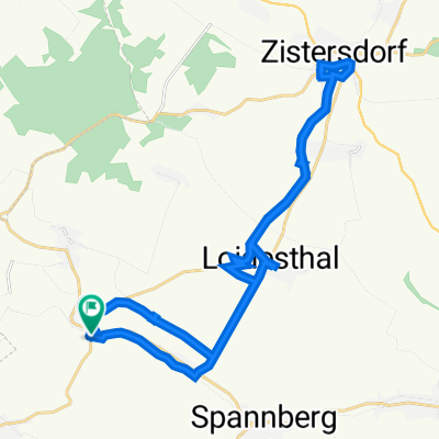
Overview
About this route
partially, beautiful climbs, beautiful view from Rochuskapelle
- -:--
- Duration
- 56 km
- Distance
- 342 m
- Ascent
- 344 m
- Descent
- ---
- Avg. speed
- 254 m
- Max. altitude

Route quality
Waytypes & surfaces along the route
Waytypes
Quiet road
30.2 km
(54 %)
Track
7.3 km
(13 %)
Surfaces
Paved
30.8 km
(55 %)
Unpaved
9.5 km
(17 %)
Asphalt
28.6 km
(51 %)
Gravel
5.6 km
(10 %)
Continue with Bikemap
Use, edit, or download this cycling route
You would like to ride traminerweg or customize it for your own trip? Here is what you can do with this Bikemap route:
Free features
- Save this route as favorite or in collections
- Copy & plan your own version of this route
- Sync your route with Garmin or Wahoo
Premium features
Free trial for 3 days, or one-time payment. More about Bikemap Premium.
- Navigate this route on iOS & Android
- Export a GPX / KML file of this route
- Create your custom printout (try it for free)
- Download this route for offline navigation
Discover more Premium features.
Get Bikemap PremiumFrom our community
Other popular routes starting in Hohenruppersdorf
 muskatellerweg
- Distance
- 73.8 km
- Ascent
- 346 m
- Descent
- 346 m
- Location
- Hohenruppersdorf, Lower Austria, Austria
 Niedersulz 149, Niedersulz nach Niedersulz 233, Niedersulz
- Distance
- 18.6 km
- Ascent
- 129 m
- Descent
- 103 m
- Location
- Hohenruppersdorf, Lower Austria, Austria
 Untere Hauptstraße, Hohenruppersdorf nach Untere Hauptstraße, Hohenruppersdorf
- Distance
- 26.5 km
- Ascent
- 278 m
- Descent
- 283 m
- Location
- Hohenruppersdorf, Lower Austria, Austria
 Niedersulz 234, Sulz im Weinviertel nach Niedersulz 227, Sulz im Weinviertel
- Distance
- 28.8 km
- Ascent
- 329 m
- Descent
- 306 m
- Location
- Hohenruppersdorf, Lower Austria, Austria
 traminerweg
- Distance
- 56 km
- Ascent
- 342 m
- Descent
- 344 m
- Location
- Hohenruppersdorf, Lower Austria, Austria
 Einfache Fahrt in Spannberg
- Distance
- 10.2 km
- Ascent
- 63 m
- Descent
- 113 m
- Location
- Hohenruppersdorf, Lower Austria, Austria
 Niedersulz 38 nach Fürlusweg 69, Schrick
- Distance
- 10.6 km
- Ascent
- 131 m
- Descent
- 75 m
- Location
- Hohenruppersdorf, Lower Austria, Austria
 Extensive Sonntag Route In Niedersulz
- Distance
- 7.1 km
- Ascent
- 101 m
- Descent
- 101 m
- Location
- Hohenruppersdorf, Lower Austria, Austria
Open it in the app