

20130805_3-Länder-Rad-Event_Tag 1
A cycling route starting in Mudau, Baden-Wurttemberg, Germany.
Overview
About this route
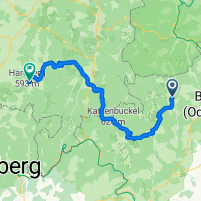
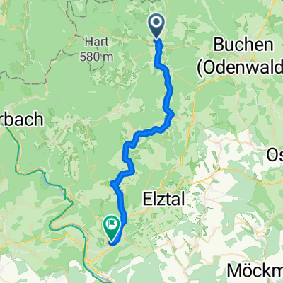
Mudau to Wald-Michelbach (Kraidacher Höhe)
- -:--
- Duration
- 57 km
- Distance
- 776 m
- Ascent
- 767 m
- Descent
- ---
- Avg. speed
- ---
- Max. altitude
Route quality
Waytypes & surfaces along the route
Waytypes
Track
18.8 km
(33 %)
Quiet road
14.8 km
(26 %)
Surfaces
Paved
33 km
(58 %)
Unpaved
14.2 km
(25 %)
Asphalt
31.3 km
(55 %)
Gravel
10.8 km
(19 %)
Continue with Bikemap
Use, edit, or download this cycling route
You would like to ride 20130805_3-Länder-Rad-Event_Tag 1 or customize it for your own trip? Here is what you can do with this Bikemap route:
Free features
- Save this route as favorite or in collections
- Copy & plan your own version of this route
- Sync your route with Garmin or Wahoo
Premium features
Free trial for 3 days, or one-time payment. More about Bikemap Premium.
- Navigate this route on iOS & Android
- Export a GPX / KML file of this route
- Create your custom printout (try it for free)
- Download this route for offline navigation
Discover more Premium features.
Get Bikemap PremiumFrom our community
Other popular routes starting in Mudau
 Tandem WE 2015 Sonntag
- Distance
- 26.8 km
- Ascent
- 420 m
- Descent
- 412 m
- Location
- Mudau, Baden-Wurttemberg, Germany
 Rund um Mudau
- Distance
- 41.9 km
- Ascent
- 438 m
- Descent
- 436 m
- Location
- Mudau, Baden-Wurttemberg, Germany
 Odenwald mit Höhen und Tiefen
- Distance
- 55.8 km
- Ascent
- 669 m
- Descent
- 669 m
- Location
- Mudau, Baden-Wurttemberg, Germany
 20130805_3-Länder-Rad-Event_Tag 1
- Distance
- 57 km
- Ascent
- 776 m
- Descent
- 767 m
- Location
- Mudau, Baden-Wurttemberg, Germany
 Mudau-Steinbach-Beuchen-Mudau über St3
- Distance
- 17.8 km
- Ascent
- 231 m
- Descent
- 231 m
- Location
- Mudau, Baden-Wurttemberg, Germany
 mudau-mosbach
- Distance
- 29.4 km
- Ascent
- 287 m
- Descent
- 578 m
- Location
- Mudau, Baden-Wurttemberg, Germany
 Limes- Niebelubgensteig
- Distance
- 36.6 km
- Ascent
- 1,044 m
- Descent
- 1,045 m
- Location
- Mudau, Baden-Wurttemberg, Germany
 trainingsrunde3
- Distance
- 24.6 km
- Ascent
- 509 m
- Descent
- 497 m
- Location
- Mudau, Baden-Wurttemberg, Germany
Open it in the app