Cepina Alpy 2013 (2.den)
- 61 km
- 1,865 m
- 1,865 m
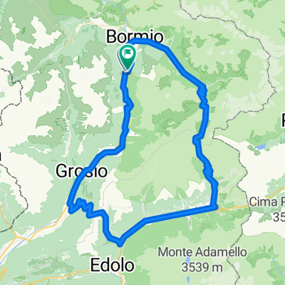
- Valdisotto, Lombardy, Italy
A cycling route starting in Valdisotto, Lombardy, Italy.
Overview
Through the slopes above Isolaccia to Amoga, along the Decouville trail to Lago di Cancano, the MTB trail to the last tunnel of Stelvio, and back to Cepina via Bormio.
created this 12 years ago
Route quality
Track
24.3 km
(40 %)
Quiet road
19.5 km
(32 %)
Paved
26.7 km
(44 %)
Unpaved
26.1 km
(43 %)
Asphalt
26.1 km
(43 %)
Ground
13.4 km
(22 %)
Route highlights
\"")
\"")
\"")
\"")
\"")
\"")
Continue with Bikemap
You would like to ride Cepina Alpy 2013 (3.den) or customize it for your own trip? Here is what you can do with this Bikemap route:
Free trial for 3 days, or one-time payment. More about Bikemap Premium.
Discover more Premium features.
Get Bikemap PremiumFrom our community
Open it in the app