
Ringelspitz
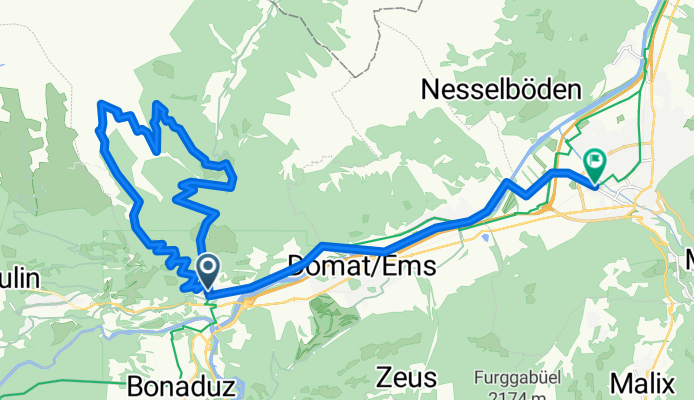
A cycling route starting in Tamins, Grisons, Switzerland.
Overview
About this route
Einfache Auffahrt zur Ringelspitz SAC Hütte. Die letzten 100Hm müssen geschoben werden.
Abfahrt ist am Anfang hauptsächlich durch Spitzkehren erschwert, danach wird es sehr flowig, teils steil. - -:--
- Duration
- 29.9 km
- Distance
- 1,379 m
- Ascent
- 1,467 m
- Descent
- ---
- Avg. speed
- ---
- Max. altitude
Continue with Bikemap
Use, edit, or download this cycling route
You would like to ride Ringelspitz or customize it for your own trip? Here is what you can do with this Bikemap route:
Free features
- Save this route as favorite or in collections
- Copy & plan your own version of this route
- Sync your route with Garmin or Wahoo
Premium features
Free trial for 3 days, or one-time payment. More about Bikemap Premium.
- Navigate this route on iOS & Android
- Export a GPX / KML file of this route
- Create your custom printout (try it for free)
- Download this route for offline navigation
Discover more Premium features.
Get Bikemap PremiumFrom our community
Other popular routes starting in Tamins
 Rheinschluchttour CLONED FROM ROUTE 32028
- Distance
- 61.5 km
- Ascent
- 1,695 m
- Descent
- 1,695 m
- Location
- Tamins, Grisons, Switzerland
 A4_Schweiz (520 km)
- Distance
- 519.6 km
- Ascent
- 6,342 m
- Descent
- 6,342 m
- Location
- Tamins, Grisons, Switzerland
 Tamins - Rundtour um die Rheinschlucht
- Distance
- 39.1 km
- Ascent
- 928 m
- Descent
- 925 m
- Location
- Tamins, Grisons, Switzerland
 Reichenau-Arosa
- Distance
- 78 km
- Ascent
- 2,883 m
- Descent
- 2,646 m
- Location
- Tamins, Grisons, Switzerland
 Rheinschluchttour CLONED FROM ROUTE 32028
- Distance
- 55.8 km
- Ascent
- 1,680 m
- Descent
- 1,680 m
- Location
- Tamins, Grisons, Switzerland
 Chur - Rona
- Distance
- 49.3 km
- Ascent
- 1,045 m
- Descent
- 281 m
- Location
- Tamins, Grisons, Switzerland
 Reichenau-Altshausen
- Distance
- 180.5 km
- Ascent
- 581 m
- Descent
- 616 m
- Location
- Tamins, Grisons, Switzerland
 Anspruchsvolle Route durchs Taminatal
- Distance
- 25.3 km
- Ascent
- 1,117 m
- Descent
- 1,276 m
- Location
- Tamins, Grisons, Switzerland
Open it in the app