

Bocklradweg - Leuchtenberg - Železná - Bor - Tlučná
A cycling route starting in Bělá nad Radbuzou, Plzeň Region, Czechia.
Overview
About this route
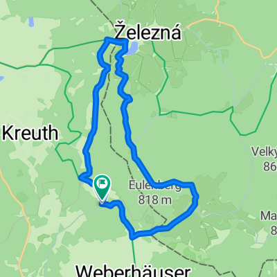
Cyklo-Bus to Železnou, from there through Eslarn along the entire Bocklradweg, back to visit Luchtenberg Castle, from the border back to Tlučná.
- -:--
- Duration
- 183 km
- Distance
- 1,058 m
- Ascent
- 1,229 m
- Descent
- ---
- Avg. speed
- ---
- Max. altitude
Route quality
Waytypes & surfaces along the route
Waytypes
Path
49.4 km
(27 %)
Quiet road
29.3 km
(16 %)
Surfaces
Paved
113.5 km
(62 %)
Unpaved
22 km
(12 %)
Asphalt
111.7 km
(61 %)
Gravel
14.6 km
(8 %)
Continue with Bikemap
Use, edit, or download this cycling route
You would like to ride Bocklradweg - Leuchtenberg - Železná - Bor - Tlučná or customize it for your own trip? Here is what you can do with this Bikemap route:
Free features
- Save this route as favorite or in collections
- Copy & plan your own version of this route
- Split it into stages to create a multi-day tour
- Sync your route with Garmin or Wahoo
Premium features
Free trial for 3 days, or one-time payment. More about Bikemap Premium.
- Navigate this route on iOS & Android
- Export a GPX / KML file of this route
- Create your custom printout (try it for free)
- Download this route for offline navigation
Discover more Premium features.
Get Bikemap PremiumFrom our community
Other popular routes starting in Bělá nad Radbuzou
 MTB - Český les - Sycherák - hrad Starý Herštejn
- Distance
- 85.6 km
- Ascent
- 1,301 m
- Descent
- 1,341 m
- Location
- Bělá nad Radbuzou, Plzeň Region, Czechia
 Friedrichshäng Rundfahrt
- Distance
- 15.6 km
- Ascent
- 373 m
- Descent
- 379 m
- Location
- Bělá nad Radbuzou, Plzeň Region, Czechia
 2015 Poldermühle--Neunburg
- Distance
- 48.5 km
- Ascent
- 289 m
- Descent
- 453 m
- Location
- Bělá nad Radbuzou, Plzeň Region, Czechia
 Paneuropa Radweg Nürnberg-Prag Teil 4 CLONED FROM ROUTE 3513
- Distance
- 77.4 km
- Ascent
- 470 m
- Descent
- 662 m
- Location
- Bělá nad Radbuzou, Plzeň Region, Czechia
 dálnice na zvon 5.4.2016
- Distance
- 27.4 km
- Ascent
- 530 m
- Descent
- 518 m
- Location
- Bělá nad Radbuzou, Plzeň Region, Czechia
 Paneuropa radweg (Germany) CLONED FROM ROUTE 99456
- Distance
- 553.5 km
- Ascent
- 1,055 m
- Descent
- 1,438 m
- Location
- Bělá nad Radbuzou, Plzeň Region, Czechia
 Sautreiber gasse
- Distance
- 33.5 km
- Ascent
- 591 m
- Descent
- 589 m
- Location
- Bělá nad Radbuzou, Plzeň Region, Czechia
 Paneuropa radweg (Germany)
- Distance
- 553.6 km
- Ascent
- 1,354 m
- Descent
- 1,744 m
- Location
- Bělá nad Radbuzou, Plzeň Region, Czechia
Open it in the app