

Zwei-Täler-Tour
A cycling route starting in Trochtelfingen, Baden-Wurttemberg, Germany.
Overview
About this route
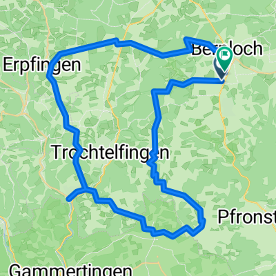
Beautiful tour with MTB or touring bike through the two river valleys of Lauchert and Erpf. The tour goes over gentle hills and through wide fields, starting from the Mägerkinger Lake and passing by Alb-Gold back to the starting point.
- -:--
- Duration
- 34.1 km
- Distance
- 267 m
- Ascent
- 267 m
- Descent
- ---
- Avg. speed
- ---
- Max. altitude

Route quality
Waytypes & surfaces along the route
Waytypes
Track
22.9 km
(67 %)
Quiet road
7.8 km
(23 %)
Surfaces
Paved
26.9 km
(79 %)
Unpaved
4.1 km
(12 %)
Asphalt
25.6 km
(75 %)
Gravel
3.1 km
(9 %)
Route highlights
Points of interest along the route
Point of interest after 2.6 km
Speidelhütte Grillstelle / Schutzhütte
Point of interest after 21.9 km
Mägerkinger See oder Lauchertsee Kiosk (saisonal)
Continue with Bikemap
Use, edit, or download this cycling route
You would like to ride Zwei-Täler-Tour or customize it for your own trip? Here is what you can do with this Bikemap route:
Free features
- Save this route as favorite or in collections
- Copy & plan your own version of this route
- Sync your route with Garmin or Wahoo
Premium features
Free trial for 3 days, or one-time payment. More about Bikemap Premium.
- Navigate this route on iOS & Android
- Export a GPX / KML file of this route
- Create your custom printout (try it for free)
- Download this route for offline navigation
Discover more Premium features.
Get Bikemap PremiumFrom our community
Other popular routes starting in Trochtelfingen
 SAS-0105 Erpfingen bis Balingen
- Distance
- 82.1 km
- Ascent
- 1,209 m
- Descent
- 1,397 m
- Location
- Trochtelfingen, Baden-Wurttemberg, Germany
 Stoppomat Pfullingen
- Distance
- 68.7 km
- Ascent
- 850 m
- Descent
- 832 m
- Location
- Trochtelfingen, Baden-Wurttemberg, Germany
 Radrunde durch Burladingen
- Distance
- 20.3 km
- Ascent
- 439 m
- Descent
- 326 m
- Location
- Trochtelfingen, Baden-Wurttemberg, Germany
 Hohenstein-Augstberg-Lauchert-See-Erpfingen
- Distance
- 47.2 km
- Ascent
- 744 m
- Descent
- 744 m
- Location
- Trochtelfingen, Baden-Wurttemberg, Germany
 Ups and downs
- Distance
- 41.8 km
- Ascent
- 912 m
- Descent
- 941 m
- Location
- Trochtelfingen, Baden-Wurttemberg, Germany
 Radrunde vom 1. Oktober, 14:53
- Distance
- 21.9 km
- Ascent
- 324 m
- Descent
- 342 m
- Location
- Trochtelfingen, Baden-Wurttemberg, Germany
 Zwei-Täler-Tour
- Distance
- 34.1 km
- Ascent
- 267 m
- Descent
- 267 m
- Location
- Trochtelfingen, Baden-Wurttemberg, Germany
 Augstbergturm-Lauchertsee
- Distance
- 30.8 km
- Ascent
- 389 m
- Descent
- 384 m
- Location
- Trochtelfingen, Baden-Wurttemberg, Germany
Open it in the app