

Na kole dětem Vysočinou 2013
A cycling route starting in Telč, Kraj Vysočina, Czechia.
Overview
About this route
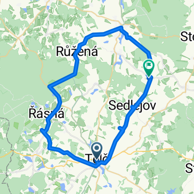
Telč-Třešť-Jihlava-Batelov-Telč
- -:--
- Duration
- 76.7 km
- Distance
- 641 m
- Ascent
- 638 m
- Descent
- ---
- Avg. speed
- ---
- Max. altitude

Route quality
Waytypes & surfaces along the route
Waytypes
Road
34.8 km
(45 %)
Busy road
21.9 km
(29 %)
Surfaces
Paved
6.2 km
(8 %)
Unpaved
6 km
(8 %)
Asphalt
6.1 km
(8 %)
Gravel
3.2 km
(4 %)
Continue with Bikemap
Use, edit, or download this cycling route
You would like to ride Na kole dětem Vysočinou 2013 or customize it for your own trip? Here is what you can do with this Bikemap route:
Free features
- Save this route as favorite or in collections
- Copy & plan your own version of this route
- Sync your route with Garmin or Wahoo
Premium features
Free trial for 3 days, or one-time payment. More about Bikemap Premium.
- Navigate this route on iOS & Android
- Export a GPX / KML file of this route
- Create your custom printout (try it for free)
- Download this route for offline navigation
Discover more Premium features.
Get Bikemap PremiumFrom our community
Other popular routes starting in Telč
 PW D7 Telc - Vronov
- Distance
- 71.4 km
- Ascent
- 647 m
- Descent
- 774 m
- Location
- Telč, Kraj Vysočina, Czechia
 Trasa z Pivovar Panský dvůr Telč do Čestín 29
- Distance
- 92.5 km
- Ascent
- 1,606 m
- Descent
- 1,638 m
- Location
- Telč, Kraj Vysočina, Czechia
 Trasa z Telč do Čestín
- Distance
- 128.9 km
- Ascent
- 2,774 m
- Descent
- 2,792 m
- Location
- Telč, Kraj Vysočina, Czechia
 Telč - Kostelní Myslová - Slaviboř - Černíč - Dolní Vilímeč - Nová Říše - Telč
- Distance
- 29.2 km
- Ascent
- 278 m
- Descent
- 278 m
- Location
- Telč, Kraj Vysočina, Czechia
 Z Řásné do Jihlavy
- Distance
- 30.2 km
- Ascent
- 354 m
- Descent
- 464 m
- Location
- Telč, Kraj Vysočina, Czechia
 ITT 16
- Distance
- 15.9 km
- Ascent
- 176 m
- Descent
- 176 m
- Location
- Telč, Kraj Vysočina, Czechia
 Sedlejov - Jedovnice
- Distance
- 132.6 km
- Ascent
- 997 m
- Descent
- 1,095 m
- Location
- Telč, Kraj Vysočina, Czechia
 2012-06-24 Telc circuit
- Distance
- 49.4 km
- Ascent
- 536 m
- Descent
- 459 m
- Location
- Telč, Kraj Vysočina, Czechia
Open it in the app