

Foktő - Fadd - Dombori - Foktő
A cycling route starting in Bátya, Bács-Kiskun county, Hungary.
Overview
About this route
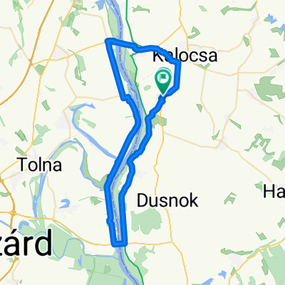
Just an easy route to the beach of Dombori and back. This route uses two ferry transfers between Meszes and Gerjen. The picture was taken in 2009 including 2009's prices.
- -:--
- Duration
- 36.2 km
- Distance
- 38 m
- Ascent
- 41 m
- Descent
- ---
- Avg. speed
- ---
- Max. altitude
Route highlights
Points of interest along the route
Point of interest after 4 km
Komp (ferry)
Point of interest after 20.1 km
Beach of Dombori
Continue with Bikemap
Use, edit, or download this cycling route
You would like to ride Foktő - Fadd - Dombori - Foktő or customize it for your own trip? Here is what you can do with this Bikemap route:
Free features
- Save this route as favorite or in collections
- Copy & plan your own version of this route
- Sync your route with Garmin or Wahoo
Premium features
Free trial for 3 days, or one-time payment. More about Bikemap Premium.
- Navigate this route on iOS & Android
- Export a GPX / KML file of this route
- Create your custom printout (try it for free)
- Download this route for offline navigation
Discover more Premium features.
Get Bikemap PremiumFrom our community
Other popular routes starting in Bátya
 2014
2014- Distance
- 36.1 km
- Ascent
- 41 m
- Descent
- 50 m
- Location
- Bátya, Bács-Kiskun county, Hungary
 Meszesi Dunapart, Kalocsa to Fő út 48., Foktő
- Distance
- 8 km
- Ascent
- 7 m
- Descent
- 7 m
- Location
- Bátya, Bács-Kiskun county, Hungary
 10. Tag Kalocsa - Solt
- Distance
- 52.7 km
- Ascent
- 13 m
- Descent
- 8 m
- Location
- Bátya, Bács-Kiskun county, Hungary
 Gerjen - Tolna
- Distance
- 16.9 km
- Ascent
- 16 m
- Descent
- 16 m
- Location
- Bátya, Bács-Kiskun county, Hungary
 3ª etapa 5/8 Kalocsa - Baja
- Distance
- 77.4 km
- Ascent
- 78 m
- Descent
- 75 m
- Location
- Bátya, Bács-Kiskun county, Hungary
 Kisdorogi kör
- Distance
- 116 km
- Ascent
- 328 m
- Descent
- 329 m
- Location
- Bátya, Bács-Kiskun county, Hungary
 Dugonics utca - Dugonics utca
- Distance
- 54 km
- Ascent
- 58 m
- Descent
- 107 m
- Location
- Bátya, Bács-Kiskun county, Hungary
 Foktő - Fadd - Dombori - Foktő
- Distance
- 36.2 km
- Ascent
- 38 m
- Descent
- 41 m
- Location
- Bátya, Bács-Kiskun county, Hungary
Open it in the app