Madeleine und Chaussy
- 72.3 km
- 2,259 m
- 2,275 m
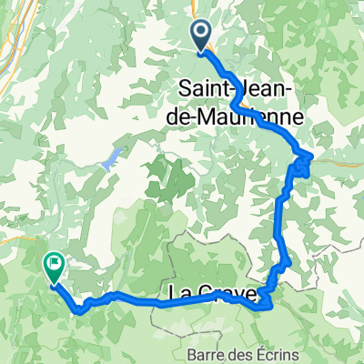
- Saint-Etienne-de-Cuines, Auvergne-Rhône-Alpes, France
A cycling route starting in Saint-Etienne-de-Cuines, Auvergne-Rhône-Alpes, France.
Overview
Part of the tour de france stage 11 2011 Col du Glandon over to Col du Croix de fer part of the Col du Molard(bad road) Col du la Madeleine
created this 12 years ago
Route quality
Road
9.1 km
(8 %)
Quiet road
2.3 km
(2 %)
Paved
66.3 km
(58 %)
Asphalt
66.3 km
(58 %)
Undefined
48 km
(42 %)
Continue with Bikemap
You would like to ride Le Etape or customize it for your own trip? Here is what you can do with this Bikemap route:
Free trial for 3 days, or one-time payment. More about Bikemap Premium.
Discover more Premium features.
Get Bikemap PremiumFrom our community
Open it in the app