

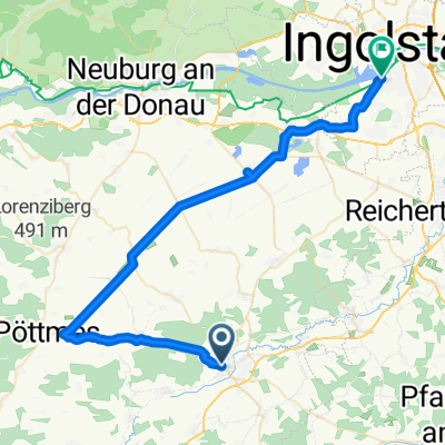
BR Radltour 2013 - Etappe 2 - Schrobenhausen - Manching- Münchsmünster - Kelheim
A cycling route starting in Schrobenhausen, Bavaria, Germany.
Overview
About this route
BR Radltour 2013 - Stage 2 - Schrobenhausen - Manching - Münchsmünster - Kelheim
- -:--
- Duration
- 80.6 km
- Distance
- 109 m
- Ascent
- 178 m
- Descent
- ---
- Avg. speed
- ---
- Max. altitude
Route quality
Waytypes & surfaces along the route
Waytypes
Road
34.7 km
(43 %)
Quiet road
17.7 km
(22 %)
Surfaces
Paved
55.6 km
(69 %)
Unpaved
2.4 km
(3 %)
Asphalt
47.6 km
(59 %)
Paved (undefined)
8.1 km
(10 %)
Continue with Bikemap
Use, edit, or download this cycling route
You would like to ride BR Radltour 2013 - Etappe 2 - Schrobenhausen - Manching- Münchsmünster - Kelheim or customize it for your own trip? Here is what you can do with this Bikemap route:
Free features
- Save this route as favorite or in collections
- Copy & plan your own version of this route
- Split it into stages to create a multi-day tour
- Sync your route with Garmin or Wahoo
Premium features
Free trial for 3 days, or one-time payment. More about Bikemap Premium.
- Navigate this route on iOS & Android
- Export a GPX / KML file of this route
- Create your custom printout (try it for free)
- Download this route for offline navigation
Discover more Premium features.
Get Bikemap PremiumFrom our community
Other popular routes starting in Schrobenhausen
 002 Hallertau
- Distance
- 65.8 km
- Ascent
- 453 m
- Descent
- 478 m
- Location
- Schrobenhausen, Bavaria, Germany
 018 SOB-Wolfsberg-Gerolsbach-SOB
- Distance
- 56.2 km
- Ascent
- 341 m
- Descent
- 341 m
- Location
- Schrobenhausen, Bavaria, Germany
 Schrobenhausen_Ingolstadt
- Distance
- 46.9 km
- Ascent
- 40 m
- Descent
- 81 m
- Location
- Schrobenhausen, Bavaria, Germany
 Gemüse-Tour
- Distance
- 43 km
- Ascent
- 151 m
- Descent
- 151 m
- Location
- Schrobenhausen, Bavaria, Germany
 Birkenheide
- Distance
- 90.8 km
- Ascent
- 212 m
- Descent
- 210 m
- Location
- Schrobenhausen, Bavaria, Germany
 Kaifeckrunde erweitert
- Distance
- 25.5 km
- Ascent
- 104 m
- Descent
- 108 m
- Location
- Schrobenhausen, Bavaria, Germany
 BR Radltour 2013 - Etappe 2 - Schrobenhausen - Manching- Münchsmünster - Kelheim
- Distance
- 80.6 km
- Ascent
- 109 m
- Descent
- 178 m
- Location
- Schrobenhausen, Bavaria, Germany
 021 SOB-Ingstetten-Pöttmes-SOB
- Distance
- 49.8 km
- Ascent
- 223 m
- Descent
- 221 m
- Location
- Schrobenhausen, Bavaria, Germany
Open it in the app