

Emmerich-Xanten-Rees-Emmerich
A cycling route starting in Emmerich, North Rhine-Westphalia, Germany.
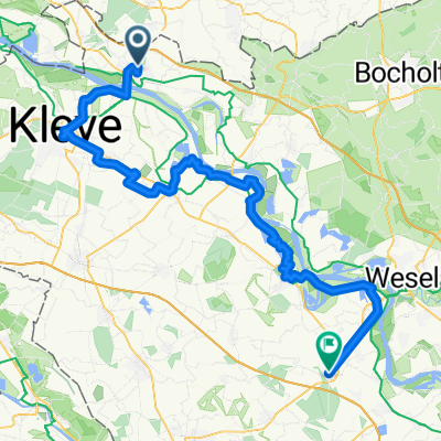
Overview
About this route
From Xanten to Rees on the ship 'Stadt Rees'
- -:--
- Duration
- 74.8 km
- Distance
- 39 m
- Ascent
- 32 m
- Descent
- ---
- Avg. speed
- ---
- Max. altitude
Continue with Bikemap
Use, edit, or download this cycling route
You would like to ride Emmerich-Xanten-Rees-Emmerich or customize it for your own trip? Here is what you can do with this Bikemap route:
Free features
- Save this route as favorite or in collections
- Copy & plan your own version of this route
- Sync your route with Garmin or Wahoo
Premium features
Free trial for 3 days, or one-time payment. More about Bikemap Premium.
- Navigate this route on iOS & Android
- Export a GPX / KML file of this route
- Create your custom printout (try it for free)
- Download this route for offline navigation
Discover more Premium features.
Get Bikemap PremiumFrom our community
Other popular routes starting in Emmerich
 14.07.29 Emmerich a. Rhein-Alpen
- Distance
- 79.2 km
- Ascent
- 49 m
- Descent
- 50 m
- Location
- Emmerich, North Rhine-Westphalia, Germany
 1997_Rhein III (Niederrhein) (Emmerich - Xanten - Düsseldorf - Köln - Mainz - Pfungstadt)
- Distance
- 433.6 km
- Ascent
- 829 m
- Descent
- 758 m
- Location
- Emmerich, North Rhine-Westphalia, Germany
 CYCLING THE RHINE: Route 06A
- Distance
- 48.2 km
- Ascent
- 42 m
- Descent
- 33 m
- Location
- Emmerich, North Rhine-Westphalia, Germany
 Emmerich-Xanten-Rees-Emmerich
- Distance
- 74.8 km
- Ascent
- 39 m
- Descent
- 32 m
- Location
- Emmerich, North Rhine-Westphalia, Germany
 RTF-Strecke 111 km Eintracht Emmerich
- Distance
- 100.9 km
- Ascent
- 136 m
- Descent
- 136 m
- Location
- Emmerich, North Rhine-Westphalia, Germany
 Emmerich-Wissel-Kalkar-Kleve-Emmerich
- Distance
- 55.6 km
- Ascent
- 271 m
- Descent
- 271 m
- Location
- Emmerich, North Rhine-Westphalia, Germany
 2. Tag Emmerich-Tolkamer-Millingen-Nijmegen-Elten-Emmerich
- Distance
- 75.3 km
- Ascent
- 180 m
- Descent
- 181 m
- Location
- Emmerich, North Rhine-Westphalia, Germany
 Emmerich-`s-Heerenberg-Ulft-Emmerich
- Distance
- 51.3 km
- Ascent
- 86 m
- Descent
- 85 m
- Location
- Emmerich, North Rhine-Westphalia, Germany
Open it in the app