Day 4: Route des Grandes Alpes by BY
- 72.6 km
- 2,113 m
- 1,488 m
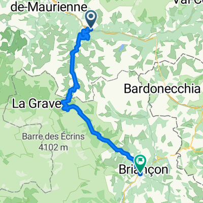
- Saint-Michel-de-Maurienne, Auvergne-Rhône-Alpes, France
A cycling route starting in Saint-Michel-de-Maurienne, Auvergne-Rhône-Alpes, France.
Overview
Col du Telegraph then Col du Galibier
created this 12 years ago
Route quality
Access road
0.4 km
(1 %)
Undefined
34.8 km
(99 %)
Paved
26.3 km
(75 %)
Asphalt
26.3 km
(75 %)
Undefined
8.8 km
(25 %)
Continue with Bikemap
You would like to ride Col du Telegraph then Col du Galibier or customize it for your own trip? Here is what you can do with this Bikemap route:
Free trial for 3 days, or one-time payment. More about Bikemap Premium.
Discover more Premium features.
Get Bikemap PremiumFrom our community
Open it in the app