

V salida de la zurra 27-8-2013 17.00h
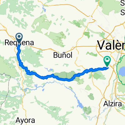
A cycling route starting in Requena, Valencia, Spain.
Overview
About this route
Requena, Villar de Olmos, Villar de Tejas, Remedio de Utiel, Utiel, Estenas, Las Nogueras, Requena.
- -:--
- Duration
- 72.1 km
- Distance
- 1,119 m
- Ascent
- 1,119 m
- Descent
- ---
- Avg. speed
- ---
- Max. altitude
Route quality
Waytypes & surfaces along the route
Waytypes
Busy road
59.2 km
(82 %)
Road
8.3 km
(12 %)
Surfaces
Paved
0.5 km
(<1 %)
Unpaved
0 km
(<1 %)
Asphalt
0.5 km
(<1 %)
Gravel
0 km
(<1 %)
Undefined
71.5 km
(99 %)
Continue with Bikemap
Use, edit, or download this cycling route
You would like to ride V salida de la zurra 27-8-2013 17.00h or customize it for your own trip? Here is what you can do with this Bikemap route:
Free features
- Save this route as favorite or in collections
- Copy & plan your own version of this route
- Sync your route with Garmin or Wahoo
Premium features
Free trial for 3 days, or one-time payment. More about Bikemap Premium.
- Navigate this route on iOS & Android
- Export a GPX / KML file of this route
- Create your custom printout (try it for free)
- Download this route for offline navigation
Discover more Premium features.
Get Bikemap PremiumFrom our community
Other popular routes starting in Requena
 Requena Valencia por Millares
- Distance
- 93.4 km
- Ascent
- 771 m
- Descent
- 1,374 m
- Location
- Requena, Valencia, Spain
 Ruta 17: Requena - Chera - Chelva
- Distance
- 62.2 km
- Ascent
- 863 m
- Descent
- 1,111 m
- Location
- Requena, Valencia, Spain
 requena - bugarra mayo/mai/may 2016
- Distance
- 74.6 km
- Ascent
- 634 m
- Descent
- 1,157 m
- Location
- Requena, Valencia, Spain
 Ruta 12: Requena - Pto Negrete -Benageber embalse
- Distance
- 55.7 km
- Ascent
- 798 m
- Descent
- 1,052 m
- Location
- Requena, Valencia, Spain
 Ruta 22: Requena - Chera - Chulilla - Emb.Loriguilla
- Distance
- 53.4 km
- Ascent
- 925 m
- Descent
- 1,305 m
- Location
- Requena, Valencia, Spain
 etape 4 2016
- Distance
- 161.3 km
- Ascent
- 1,005 m
- Descent
- 1,470 m
- Location
- Requena, Valencia, Spain
 Ruta 36 : Requena - Utiel
- Distance
- 39.2 km
- Ascent
- 755 m
- Descent
- 733 m
- Location
- Requena, Valencia, Spain
 V salida de la zurra 27-8-2013 17.00h
- Distance
- 72.1 km
- Ascent
- 1,119 m
- Descent
- 1,119 m
- Location
- Requena, Valencia, Spain
Open it in the app