

Plateau de Beille
A cycling route starting in Mercus-Garrabet, Occitanie, France.
Overview
About this route
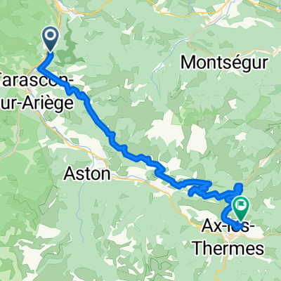
There and back to the famous Plateau de Beille from a small village close to Tarascon-s-Ariege. I would have preferred a round trip, but I didn't find any alternatives to the N20 national road which seemed to be the worst choice. On the other hand, this little mountain pass really worth a visit.
- -:--
- Duration
- 30.8 km
- Distance
- 2,202 m
- Ascent
- 2,202 m
- Descent
- ---
- Avg. speed
- ---
- Max. altitude

Route quality
Waytypes & surfaces along the route
Waytypes
Road
23.4 km
(76 %)
Quiet road
5.9 km
(19 %)
Undefined
1.5 km
(5 %)
Surfaces
Paved
18.5 km
(60 %)
Asphalt
18.5 km
(60 %)
Undefined
12.3 km
(40 %)
Continue with Bikemap
Use, edit, or download this cycling route
You would like to ride Plateau de Beille or customize it for your own trip? Here is what you can do with this Bikemap route:
Free features
- Save this route as favorite or in collections
- Copy & plan your own version of this route
- Sync your route with Garmin or Wahoo
Premium features
Free trial for 3 days, or one-time payment. More about Bikemap Premium.
- Navigate this route on iOS & Android
- Export a GPX / KML file of this route
- Create your custom printout (try it for free)
- Download this route for offline navigation
Discover more Premium features.
Get Bikemap PremiumFrom our community
Other popular routes starting in Mercus-Garrabet
 Col de Lers
- Distance
- 16.1 km
- Ascent
- 680 m
- Descent
- 51 m
- Location
- Mercus-Garrabet, Occitanie, France
 Vichy - Perpignan 1996 Etappe 15
- Distance
- 46.5 km
- Ascent
- 1,219 m
- Descent
- 566 m
- Location
- Mercus-Garrabet, Occitanie, France
 Les corniches curta
- Distance
- 40.2 km
- Ascent
- 517 m
- Descent
- 516 m
- Location
- Mercus-Garrabet, Occitanie, France
 Francie 2012 14.den
- Distance
- 46.6 km
- Ascent
- 715 m
- Descent
- 715 m
- Location
- Mercus-Garrabet, Occitanie, France
 PYG-Pyrenees Whole route 2.0
- Distance
- 2,133.6 km
- Ascent
- 1,954 m
- Descent
- 589 m
- Location
- Mercus-Garrabet, Occitanie, France
 Montréjeau - Le Bout de Touron
- Distance
- 200 km
- Ascent
- 3,821 m
- Descent
- 4,786 m
- Location
- Mercus-Garrabet, Occitanie, France
 3_Bompas_Portet D'Aspet
- Distance
- 119.3 km
- Ascent
- 2,818 m
- Descent
- 2,447 m
- Location
- Mercus-Garrabet, Occitanie, France
 Les corniches llarga
- Distance
- 54.8 km
- Ascent
- 663 m
- Descent
- 661 m
- Location
- Mercus-Garrabet, Occitanie, France
Open it in the app