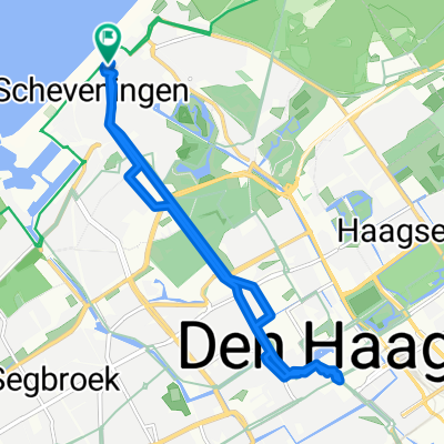
gemeentemuzeum den haag
A cycling route starting in Scheveningen, South Holland, The Netherlands.
Overview
About this route
h.f.
- -:--
- Duration
- 5.2 km
- Distance
- 4 m
- Ascent
- 12 m
- Descent
- ---
- Avg. speed
- ---
- Max. altitude
Route quality
Waytypes & surfaces along the route
Waytypes
Quiet road
2.4 km
(45 %)
Cycleway
1.4 km
(26 %)
Surfaces
Paved
1.9 km
(37 %)
Asphalt
1.9 km
(37 %)
Undefined
3.3 km
(63 %)
Continue with Bikemap
Use, edit, or download this cycling route
You would like to ride gemeentemuzeum den haag or customize it for your own trip? Here is what you can do with this Bikemap route:
Free features
- Save this route as favorite or in collections
- Copy & plan your own version of this route
- Sync your route with Garmin or Wahoo
Premium features
Free trial for 3 days, or one-time payment. More about Bikemap Premium.
- Navigate this route on iOS & Android
- Export a GPX / KML file of this route
- Create your custom printout (try it for free)
- Download this route for offline navigation
Discover more Premium features.
Get Bikemap PremiumFrom our community
Other popular routes starting in Scheveningen
Tandem: Den Haag-Noorden- Distance
- 101.7 km
- Ascent
- 24 m
- Descent
- 28 m
- Location
- Scheveningen, South Holland, The Netherlands
rondje floor hoek van holland- Distance
- 52.9 km
- Ascent
- 15 m
- Descent
- 17 m
- Location
- Scheveningen, South Holland, The Netherlands
Hoek van Holland 145 km- Distance
- 145.3 km
- Ascent
- 5 m
- Descent
- 16 m
- Location
- Scheveningen, South Holland, The Netherlands
Kastelenroute Den Haag-Amsterdam- Distance
- 554 km
- Ascent
- 944 m
- Descent
- 948 m
- Location
- Scheveningen, South Holland, The Netherlands
58K - Den Haag to Den Haag loop- Distance
- 58.5 km
- Ascent
- 54 m
- Descent
- 54 m
- Location
- Scheveningen, South Holland, The Netherlands
Haag - Noordwij- Distance
- 25.7 km
- Ascent
- 73 m
- Descent
- 69 m
- Location
- Scheveningen, South Holland, The Netherlands
Den Haag-Wassenaar-Zoetermer-Den Haag- Distance
- 58.7 km
- Ascent
- 27 m
- Descent
- 26 m
- Location
- Scheveningen, South Holland, The Netherlands
Wandelnet_route- Distance
- 12.2 km
- Ascent
- 52 m
- Descent
- 52 m
- Location
- Scheveningen, South Holland, The Netherlands
Open it in the app

