edale to grindleford then a swift descent to hathersage
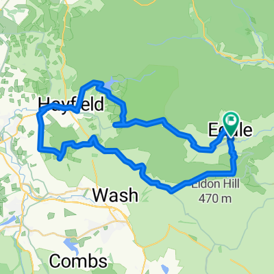
A cycling route starting in High Peak, England, United Kingdom.
Overview
About this route
My first ride in the peak district. No severe climbs but some very quick descents!
- -:--
- Duration
- 49.7 km
- Distance
- 568 m
- Ascent
- 570 m
- Descent
- ---
- Avg. speed
- ---
- Avg. speed
Route quality
Waytypes & surfaces along the route
Waytypes
Busy road
24.2 km
(49 %)
Road
16.1 km
(32 %)
Surfaces
Paved
26 km
(52 %)
Unpaved
0.4 km
(<1 %)
Asphalt
25.8 km
(52 %)
Gravel
0.4 km
(<1 %)
Continue with Bikemap
Use, edit, or download this cycling route
You would like to ride edale to grindleford then a swift descent to hathersage or customize it for your own trip? Here is what you can do with this Bikemap route:
Free features
- Save this route as favorite or in collections
- Copy & plan your own version of this route
- Sync your route with Garmin or Wahoo
Premium features
Free trial for 3 days, or one-time payment. More about Bikemap Premium.
- Navigate this route on iOS & Android
- Export a GPX / KML file of this route
- Create your custom printout (try it for free)
- Download this route for offline navigation
Discover more Premium features.
Get Bikemap PremiumFrom our community
Other popular routes starting in High Peak
- Edale kinder reservoir mam tor
- Distance
- 36.4 km
- Ascent
- 1,035 m
- Descent
- 1,034 m
- Location
- High Peak, England, United Kingdom
- edale to grindleford then a swift descent to hathersage
- Distance
- 49.7 km
- Ascent
- 568 m
- Descent
- 570 m
- Location
- High Peak, England, United Kingdom
- Mam Tor to Sheffield
- Distance
- 25.3 km
- Ascent
- 379 m
- Descent
- 622 m
- Location
- High Peak, England, United Kingdom
- Snake Pass circular
- Distance
- 105.2 km
- Ascent
- 1,155 m
- Descent
- 1,157 m
- Location
- High Peak, England, United Kingdom
- 30k MTB Edale Peak District
- Distance
- 29.4 km
- Ascent
- 916 m
- Descent
- 916 m
- Location
- High Peak, England, United Kingdom
- Edale
- Distance
- 21.6 km
- Ascent
- 718 m
- Descent
- 719 m
- Location
- High Peak, England, United Kingdom
- Mam Nick near Castleton
- Distance
- 2.1 km
- Ascent
- 209 m
- Descent
- 0 m
- Location
- High Peak, England, United Kingdom
- Two Dales Loop Options
- Distance
- 45.4 km
- Ascent
- 1,232 m
- Descent
- 1,233 m
- Location
- High Peak, England, United Kingdom
Open it in the app